Thank you…

12 04 2010

A huge thank you to everyone that has left their thoughts and prayers. It means so much to Carol and to myself that so many of you have taken the time to leave your thoughts. My dad would be so happy.

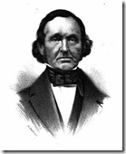
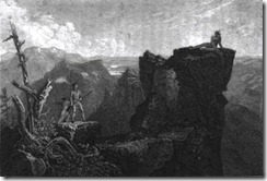
Here is a picture of Mike from about 12 years ago, before he ever started this project…

A few of you have asked me to pick up where my dad left off with this, and I would love to get his work published. He obviously has done his homework here, and soon I will start to go through all of his files and photos and see what I can do. I am no MikeNH, but I would like to finish what he started. Thank you again for all of your thoughts and kind words, I really appreciate it and know that my dad would have to.


A Sad Day

11 04 2010

Hello Readers of Mike in New Hampshire.

This is Mike’s daughter, Jessica. This will be my first and only guest blog on my dad’s beloved blog.

Mike passed away yesterday April 10, 2010, from a heart attack. He was 51.

I know that there are some of you who visit here often, so I thought that instead of letting you wonder where he had gone and why he was not writing anymore, he would want me to let you all know.

In the past few months, I know that he worked really hard to put this blog together and to make it great. He loved New Hampshire and he loved History, so I am happy that he started this project to share these things with you.

Even if no one actually read this blog, I’m pretty sure that he wouldn’t care, because taking pictures, “marker hunting”, writing about them and compiling this all made his last several months full and fun.

Thank you for reading his blog, and let it serve as a small memorial to my dad. He was a great guy, and he will be very missed.


#20 Captain Lovewell’s War

29 03 2010

Marker Text:

Was fought between 1722 and 1725 against several tribes of eastern Indians. The principal campaigns took place in the Ossipee region and led to the eventual withdrawal of the Indians to the north. Commemorated in Colonial literature by "The Ballad of Lovewell’s Fight." 

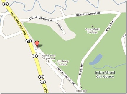
I was unable to locate this marker, erected in 1965, on a trip up Rt. 16.  It’s possible it was hidden behind plowed snow.  The map below represents a “best estimate” of the location.  The NH state description reads  “Located in a grassy plot about 2.5 miles north of Center Ossipee on NH 16 and 25, just north of the point where NH 16 combines with NH 25.”

#20 
As we have seen from the previous marker, Nottingham, the westward expansion of New Hampshire away from the seacoast began in earnest in the 1720s.  The same thing was occurring next door in Maine as English settlements were being established along the Kennebec River deeper into the frontier.

There were two groups of folks that weren’t too happy about all this.  The Indians, and the French.  But mostly the French.  They considered most of Maine their property and, following their tried and true tactics, goaded the local Abenaki Indians into the usual raids on frontier settlements.  For many years the French were operating out of Montreal and today’s Canadian Provinces with access to the Atlantic.  They also brought with them Jesuit Missionaries.  These missionaries went out into the frontiers and established small churches among the Indians, teaching them and converting many to Catholicism.  I bet you know what’s coming next.

Clipped image from 'Up' trailerFrance and England were in an uneasy peace for now, but the recent history of religious arguments and the English Civil War (posted about here and here) left the two countries polarized.  And that spilled over to New England.  The French, knowing the Indians were a superstitious people, convinced the Abenaki that the English were not interested in teaching them about God, and it was a sin to take their land (which of course the French were doing as well, but … Squirrel!  They didn’t want them noticing that.)

So the Indians, prodded by the French burned down farms, killed livestock, and generally made life hell on the frontier.  The English responded in the usual manner establishing Garrisons and Forts, and sending out hunting parties to track down the perpetrators.   By 1721 things had really gone downhill, and at a meeting on Arrowsic Island ME., three Jesuits accompanied by Indians delivered a letter from the various tribes to the English giving them 3 weeks to get out of Maine or they would Murder them all and burn down their settlements.

The English were having none of that.  One of the Jesuits, Sebastian Ralle was a particular troublemaker that had his little enclave near today’s Norridgewock ME.  That winter a party of men was sent to capture him, but he escaped in to the woods.  They took his strongbox which contained incriminating letters to and from the French Governor in Montreal, detailing the efforts to turn the Indians against the English.  It was time for war!

The 4th French and Indian War was known by various names and lasted from 1721to1725. The most common was “Dummer’s War” and it’s also referred to occasionally as “Captain Lovewell’s War” which brings us to our marker.

ONE of the few incidents of Indian warfare naturally susceptible of the moonlight of romance was that expedition undertaken for the defence of the frontiers in the year 1725, which resulted in the well-remembered "Lovell’s Fight."

Nathaniel Hawthorne, in his introduction to Roger Malvin’s Burial, from the collection of short stories “Mosses from an old Manse” 1854.  Hawthorne writes a story about two wounded survivors of Lovewell’s final battle.

The heroics and story of Lovewell and his final battle were told throughout New England, and he and his men became early American Hero’s for their deeds.  The centuries have dimmed the memories and stories, but they are still there to be found.

Lovewell commanded a group of militia from Old Dunstable (probably from what is today’s Nashua) known as “The Snowshoe Men.”  Originally tasked with protecting the town, they were recruited to run scouting missions up the Merrimack river and into the Lake Winnepesauke area.  They became so good at tracking and killing Indian raiders his contingent of men was increased to 70.

#20-2 In the Winter of 1725 Lovewell set out on another campaign north toward Winnepesauke.  When they arrived and scouted the usual Indian campsites they found that none had returned to the area.  He sent back 30 men, and led the rest east toward the Piscataqua and the lakes near today’s Wakefield.  The Indian raiders from the north frequently came by this area on their way to the coastal settlements.

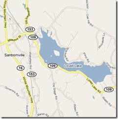
On February 20th, just before sunset they spotted smoke from a campfire along the shore of a lake.  Lovewell hid until midnight, and quietly advanced on what was a fully equipped raiding party bound for Dover.  They made short work of the sleeping Indians.  Today, “Lovell Lake” in Wakefield (above) honors the Captain for his deeds.

The men then travelled south to Dover and Boston – scalps in hand – to collect the £100 per scalp bounty, and to resupply for their next mission.  In mid march they set out for a known hostile Indian village even further north named Pequacket.

46 men left Boston including a Chaplain and surgeon.  By the time they arrived at Ossipee Lake, 2 men had been forced to turn back, others were sick.  They stopped on the west side of the lake to construct a small fort.  Partially, it was in case they needed a place to retreat to from battle (there were no settlements this far north) and also as a place to leave the sick. 10 men remained behind at the fort, and 34 men resumed their march north in early May.

#20a

On the morning of May 8th, while encamped by a pond, Lovewell’s party heard the firing of a gun and saw a lone Indian across the pond.  After discussing strategy the men assembled and circled the lake.  They dropped their packs for easier movement and fighting, then followed and killed the lone Indian.

#20b

They returned to the place they dropped their packs, only to find them gone.  The Indians had taken them. Paugus, the Indian chief had been following the English tracks.  He determined that his tribe greatly outnumbered Lovewell and intended to fight.  About 10am, while Lovewell’s party was searching for their packs, Paugus attacked.

20c

Almost as soon as the intense fighting began Lovewell was shot and killed along with 8 other men.  Paugus took casualties as well, but the English were seriously outnumbered.  Paugus moved in to try and surround them and force surrender or kill them all.  Lieutenant Wyman took over, and rallied the men to keep up the fight, having herded the men into a defensible position among rocks and logs with water offering protection from complete encirclement.

The fight raged on all day and to sunset.  Lovewell’s men made a mighty stand and continued to thin the ranks of Indians.  At nightfall the Indians retreated into the safety of the woods. Wyman waited until the moon rose and around midnight, began a retreat to the fort at Ossipee.

#20c 

The retreat was initially 21 men, many mortally wounded.  Some would never reach the fort at Ossipee.  2 men were too wounded to retreat and were left at the battle site alive with freshly loaded weapons.  Of the 21, 5 would die before reaching a settlement due to lack of provisions or medical help.  Those that did reach the fort found it abandoned.  Some say as soon as the fighting started one man fled the field to warn the fort, and they all ran off.  So the survivors had no packs, no food, no supplies and a long way to go.  More than 50 miles to travel to the nearest settlements.

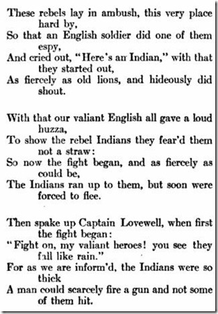
It’s hard to determine the actual number of Indians involved in the fight, but many put it around 80 (not just our poet friend above).  When a party returned to the site of the battle they found and buried Lovewell and his men, and found Indian graves, one of which contained the body of Paugus.

THE BATTLE OF LOVELL’S POND
Henry Wadsworth-Longfellow

Cold, cold is the north wind and rude is the blast
That sweeps like a hurricane loudly and fast,
As it moans through the tall waving pines lone and drear,
Sighs a requiem sad o’er the warrior’s bier.

The war-whoop is still, and the savage’s yell
Has sunk into silence along the wild dell;
The din of the battle, the tumult, is o’er,
And the war-clarion’s voice is now heard no more.

The warriors that fought for their country, and bled,
Have sunk to their rest; the damp earth is their bed;
No stone tells the place where their ashes repose,
Nor points out the spot from the graves of their foes.

They died in their glory, surrounded by fame,
And Victory’s loud trump their death did proclaim;
They are dead; but they live in each Patriot’s breast,
And their names are engraven on honor’s bright crest.

“These verses were written by Longfellow in his fourteenth year, and have interest as the first of his writing to appear in print. They were published in the Portland Gazette November 17, 1820.”

The Indians would abandon  Pequacket village after the battle and head north to Canada.  Today we know the place of this battle as Fryeburg, ME.  The Pond where the battle occurred is named Lovewell’s Pond.

The survivors and the families of the dead would be greatly rewarded for their actions.  The next marker will touch on that a bit.

Postscript:

Besides the books and sources linked in the post and the usual references linked in the sidebar, I used a few other on-line resources as well. 

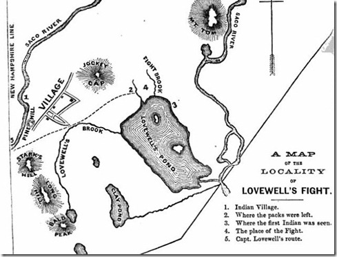
  • An Interesting book first published in 1725 “The original account of Capt. John Lovewell’s "great fight" with the Indians” has all the names of the men involved and was the source of the map. 
  • The Hawthorne and Longfellow story and poem are appropriately linked to the original works.
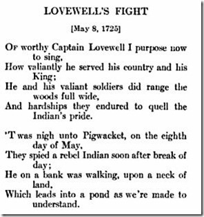
  • The excerpted poem screenshots are from an unknown author, and are snips of a much longer “Ballad of Lovewell’s Fight”.  It’s in the volume “Poems of American History” written in 1922.
  • There is another poem “Lovewell’s Fight” by  Thomas Upham that can be found in a collection published in 1822.


Colors of March along the Connecticut River Valley

19 03 2010

Once again Sue at Life Looms Large is requesting colors of the month.  Having missed last month, I’ll try to make up for it with extra photos taken on a Historic Marker hunt down the Connecticut River Valley earlier this month.  The only constant this fine day was a beautiful blue sky.

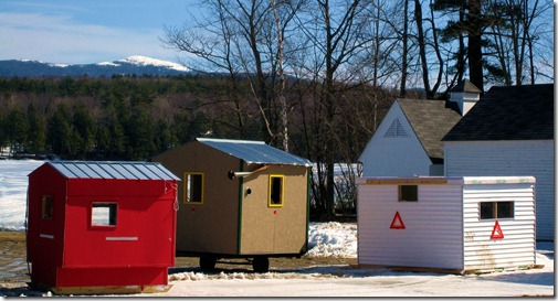
#21 zpic3March is when the ice fishing shacks begin to be removed from the many lakes in New Hampshire.  This is taken in Canaan, NH. with Canaan Street Lake in the background, and a snowy Mt. Cardigan in the distance.

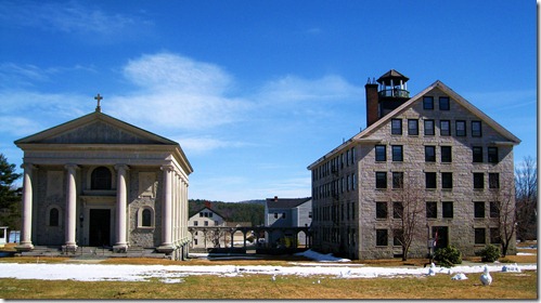
#202 zpic4 Enfield is home to Enfield Shaker Village.  The “Great Stone Dwelling” is on the right, their chapel on the left.

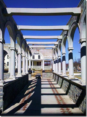
2010-03-06 12.29.43Contrast.  The noon time sun creates complex patterns on the walkway between the Great Stone House and the Chapel.

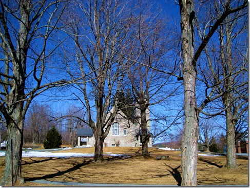
#77 zpic3Oak trees stand guard over the chapel at Kimbal Union Academy.

#134 zpic4St. Gaudens National Historic Site is home to miles of walking trails in the nearby forests.  A colony for artsy types back in the day to find their muse, it’s open to all us little people now.

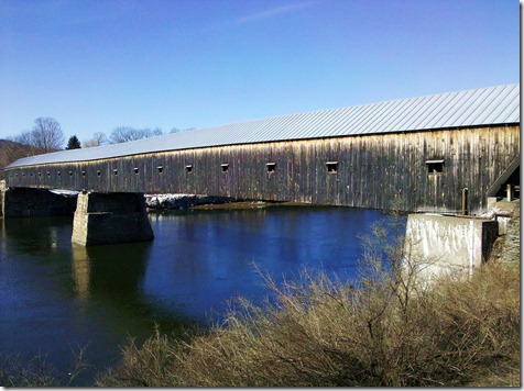
2010-03-06 14.10.58The Cornish-Windsor Bridge over the Connecticut River.  Connecting …uh… Cornish NH., and Windsor VT. It should be named the “Mostly Cornish-Tiny bit Windsor” bridge, as New Hampshire owns the whole thing to the opposite shore, and pays for upkeep.

#41 zpic1A skinny little church.  It’s actually St. Mary’s, the first Roman Catholic Church in NH.  Built in 1823 in Claremont, it’s surrounded by the cemetery on 3 sides.

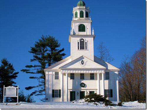
#74 zpic1The old meeting houses of New Hampshire are beautiful things.  The Park Hill meeting house in Westmoreland was built in 1762.  They didn’t like it where it was, so in 1779 they fired up the trusty Ox carts, took it apart, and reassembled it here.  The steeple houses a bell cast by the Paul Revere Foundry, circa 1826.

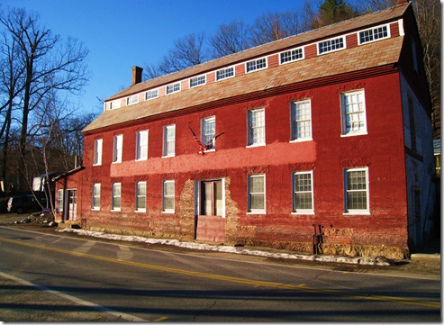
#112 zpic1In this unassuming building, steam powered autos were built back in the 1870s.  Wish I could have unfurled the flag.

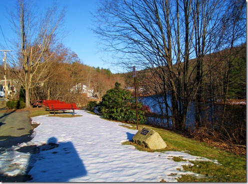
#204 zpic3As the March 6th sun begins to get low in the sky, the shadow of a Historical Marker hides my own.  Didn’t want to ruin the shot.  The Ashuelot River winds its way past “Granite State Mowing Machine Park” in Hinsdale.  Yes, there’s a Marker for that.

And so a great day comes to a close in the furthest southwest corner of the state.  For the record, the lovely Carol and I located anther 20 Historical Markers.  How is it possible to find so many in a day?  I cheat.  I’ll save the dirty little secret for another post.


#85 Nottingham Chartered 1722

9 03 2010

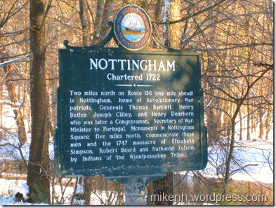
#85 Nottingham

Marker Text:

Two miles north on Route 156 (one mile ahead) is Nottingham, home of Revolutionary War Patriots, Generals Thomas Bartlett, Henry Butler, Joseph Cilley, and Henry Dearborn who was later a Congressman, Secretary of War, and Minister to Portugal. Monuments in Nottingham Square, five miles north, commemorate these men and the 1747 massacre of Elizabeth Simpson, Robert Beard and Nathaniel Folson by Indians of the Winnipesaukee Tribe.

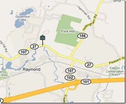
This marker is located on Rt 27/107 in Raymond, about 3/4mi west of the junction of Rt 156.  Nottingham Square is 5 miles north on Rt 156.

#85

Land grants were coming fast and furious in the 1700s.  Massachusetts had pretty standard language for all of them, and reading this stuff can put you to sleep quick.  I hope that’s not the case here as we see how a town on the edge of the frontier came to be.

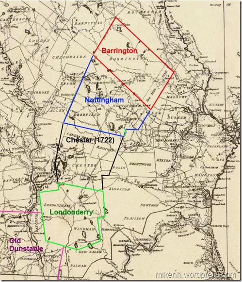
The Nottingham land grant is the next in the expansion of New Hampshire, extending a protective ring westward from the coast. Old Dunstable-1673, the Scotch-Irish settlement (Londonderry)-1719, and The Two Mile Streak-1719 in Barrington were all being populated around this time.  When Nottingham is added (containing today’s towns of Nottingham, Deerfield and Northwood) there is an effective wall set up to help guard against Indian attacks and expand the wealth of New Hampshire.  A map might help here.

notmap2 The grants of the early 1720s.

The request for a land charter was submitted without a suggested name to Boston on April 19, 1721 and signed by 101 men. Boston responded on April 28th:

We, the dwellers at Boston, being in number a considerable part of the persons entered in a petition late granted by the authority of New Hampshire, April 21,1721, for settling a town norwestward of Exeter, etc., at a meeting among ourselves duly warned,

It is voted, That the tract of land contained and set forth in the said petition shall be called New Boston, if our brethren at Newbury and elsewhere are of the same mind, and the gentlemen of the province of New Hampshire approve of ye same to whom we submit the matter.

The people named in the charter were of many different backgrounds and motives.  Most of them came from coastal areas from Portsmouth to Boston. Land speculators were involved, as were entrepreneurs trying to expand their wealth.  Many were veterans of various Indian wars – or their heirs -  granted land as payment for service to the colonies.  20 New Hampshire men were added to the charter in December 1721 by the folks in Exeter who were responsible for it’s execution.

Town of Nottingham SealBut all of them – regardless of station or wealth – were required meet the terms of the grant.  The Royal Charter from George I, dated May 10, 1722 lays out all the details of elections and such.  Each “Proprietor” was required to build a house and plow up and fence in at least 3 acres of land within 3 years, and plant the fields in the 4th year.  Oh, and the charter changed the name to Nottingham.

Land was set aside for the Proprietors to build a town Meeting House, school and parsonage within 4 years.  They were also required to pay for any protection that may be needed and a town minister.

Charter in hand, the Proprietors went about the business of building a town.  Planning meetings were held in Portsmouth or Exeter.  At the first meeting in Exeter in June it was decided that “Major John Gilman, Capt. John Gilman and Capt. John Wadleigh be a committee to agree with men to build a bridge and make good ways to Nottingham.” As noted in a previous post, the Gilman family were quite influential in early Exeter.

There were no roads.  The bridge in question was over the Lamprey River to facilitate connecting the town to Exeter.  It took 2 years to build a way in, survey the land and finally get to the point where they could parcel out land.

The description of the chosen town center from 1724 is told to us thusly:

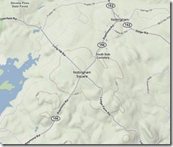
notmap3 “But the position chosen for the compact part of the town was "beautiful for situation." It was upon the height of a large swell of land, gently sloping in every direction. It was twenty-five miles south-east from what is now the state capital, fourteen miles north-west from Exeter, and twenty west from Portsmouth. The blue waters of the Atlantic, and the white canvas of vessels entering the harbor at Portsmouth, could be distinctly seen; while little lakes sparkled like gems in the wilderness, and Pawtuckaway Mountain gracefully rose in the west, and Saddleback in a more northerly direction, and babbling streams, affording ample water-power, found their way along the valleys. Here, at an elevation of about four hundred and fifty feet above the sea level, they laid out a compact village with great exactness in the form of a cross.“

The small map above (click for big) shows Nottingham Square today, with the originally laid out roads in the form of a cross. The four streets were originally named King St (Southeast to Exeter and the Lamprey bridge), Fish St. (Southwest to “Tuckaway” pond), Bow St (Northwest to Bow pond), and North St. (Northeast toward North River). Roads are said to have been built “Four Rods wide” – about 64 feet!

Parcels of land at the center were assigned to the meeting house, schools, and of course, special plots for the Governor and Lt. Governor.  A total of 134 plots were parceled and lots drawn for ownership.  Generally, the further from town, the more acreage.

The first meeting held in Nottingham itself occurred in 1727 in the town “Block House” – or meeting house.  By then the roads had been laid, town center built and folks were beginning to work the land.  The first order of business was to raise funds to build a mill on the “Tuckaway” river to process lumber.

Like many of the settlements around this time lumber, charcoal and Ships Masts (required by law to be sent to England for the Navy) were the main sources of income.  Farming was of less value because of our rocky soil, but it was good land for raising livestock and planting crops for a family’s use.

Over the next 60 years as Nottingham grew, people in the farther reaches of the town were complaining that it was to far to the town center.  The original planners misjudged the actual size of the grant and positioned the town center in the southeast corner of the grant.  Deerfield would later be set off as it’s own town in 1766, and the folks who lived in what they then called the “North Woods” would split again in 1773 to become Northwood.

It’s hard to imagine the New Hampshire of the 1720s-1730s. Mr. Elliott Colby Cogswell History of Nottingham, Deerfield, and Northwood 1878  gives a glimpse into the early pioneer spirit.

notpic "VARIOUS motives prompted men to engage in the settlement of some of our towns. Some were actuated by a spirit of enterprise. They delighted in seeing highways cut through the wilderness, smoke ascending from many a hill-top, — sign that the woodman’s ax was effecting clearings and rude dwellings were being constructed for those who were willing to dare and endure. It was for the greater safety of the lower towns to have the frontiers extended further from the coast-line, and the towns that were the centers of trade and influence encouraged every attempt to effect a new settlement.”

Postscript:

Mr. Cogswell’s book, celebrating the Northwood centennial was the only source used for this post.  The proceedings of the event are covered, including poetry, song, speeches, etc.  I didn’t read all the speeches (they sure could speechify back then) but enjoyed “The Old Elm Tree” by S. Clarke Buzell was my favorite of those I did.  Check it out if you have a moment extra.


Historic Marker facts that may only interest me.

4 03 2010
  • The State list is numbered 1 to 204.
  • There is no marker #189.
  • There is however a marker #122 and 122a. A 2 sided marker with different titles and text on each side.  It’s at the Mt. Washington Hotel.
  • Marker #193 Has different titles and text on both sides, but there is no #193a.
  • This marker is not documented anywhere.  It was put up in 1981.  There was only one other marker erected that year, #141.  There are already markers #140 and #142.
  • This next marker – #144 – was re-written.  The original went up in 1982 and is pictured on the right (photo dated 2007).  Today it looks like the one on the right (photo from January 2010).  It’s dated 2008. The state still lists the text from the original marker.  Any guesses to why it was changed? (Click for readable bigness).#144 First Meeting House
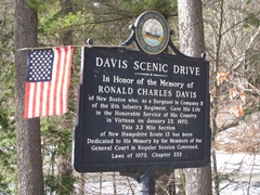
  • This marker was authorized by the State Legislature, not the usual agency.  “Davis Scenic Drive”. There are 2 identical ones, one at each end of the Scenic Byway.#999 Davis Scenic Drive
  • To date, there are 8 new markers located that have been erected since 2007.
  • The newest marker will be unveiled and dedicated this month in Barrington. “Deputy Sheriff Charles  E. Smith.”#903 zpic10

So there you have it.  Many of these are probably typos in the state database, or the quirks of different folks keying in the information.  Updating the state web site is a low priority right now, or so they tell me in emails.

How many markers are there really?  Hard to say.  If you happen upon a marker dated 2007 or later, jot down the title and leave a comment.  You may have found one no one else has!


Road Trip 1: The Seacoast, Portsmouth and Rye *Updated!*

3 03 2010

*UPDATE* Printable PDF Road Trip 1

With spring just a few weeks away it’s time to introduce a new blog feature, Road Trips!  This is the first of what I hope will be many that will be cataloged by region in the Road Trips menu bar above.

If you have a request for a trip through a particular region, the Road Trips page is open for comments.  Go ahead and leave a suggestion, and I’ll work one up.

The Seacoast inside I95 is home to 14 markers (15 if we include the Weeks House just on the other side of the highway).  Marker Icons on the maps have blog posts already, green placemarks do not. Blogged markers are linked as appropriate.

There are 2 clusters of markers inside I95; Portsmouth/Rye and Hampton/Seabrook.

This Road Trip will cover the northern markers through Portsmouth, down the coast, and finishing up at the North Hampton/Rye border on Rt 1.  9 markers with an optional 10th (Weeks House).  Hampton and Seabrook will be the next road trip (and a shorter one, at that).

Part 1: Portsmouth.

75zpic1[1] The first marker is #75 Portsmouth Plains . From I95 (north or south) get off at Exit 3, and take a right at the end of the ramp.  The Marker is about a mile past the interstate on your left.   From the south coast, get on Rt 1 north, and take a left at the lights after Lafayette Plaza Shopping Center onto Peverly Hill Rd, the left at the junction of Rt 33 (about a mile) the marker is just to your right.  Not much to see here except a baseball field. It’s more a drive-by marker than a stop and visit marker.  It was a different place 314 years ago.

In the pre-dawn hours of June 26, 1696, Indians attacked the settlement here. Fourteen persons were killed and others taken captive. Five houses and nine barns were burned. This plain was the Training Field and Muster Ground. Close by stood the famous Plains Tavern (1728-1914) with its Bowling Green where many distinguished visitors were entertained.”
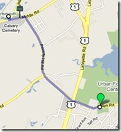
road1bFrom here take a right on Peverly Hill Rd just to the east, cross Rt 1 at the lights onto  Elwyn Rd.  Marker #127, John Langdon.  It’s on the left about 1/4 mile past Rt 1.

Signatory to the Constitution, Governor, President of the U.S Senate among other amazing accomplishments.  He was born on this farm in 1741.  This marker is different from many others, the text continues on the reverse side.  The house is open for tours from June through October, or you can rent the grounds for your next shindig.

Mr. Langdon will be covered in detail once we get to the Revolution.

Our next marker is #194 Wentworth- Coolidge Mansion.  Continue east on Elwyn Rd. to the Rotary, then north on Sagamore Ave.  The marker is a mile ahead, just past the intersection with Little Harbor Rd.  Take a right on Little Harbor Rd and follow it to the end to get to the actual Mansion.

road1c

I hope you brought some snacks to munch along the way, as this is a beautiful spot on a nice day. The official State Park page is here. I’d recommend this spot for some great photo opportunities.  Here are a few from a visit last fall.
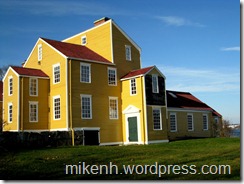
#194 zpic3 #194 zpic5

When you’re finished taking in the view, hop back in the car and head back out to Sagamore Ave.

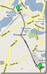
This next marker is optional.  If you don’t mind navigating across downtown, then backtracking through the city again,  head for marker #114 North Cemetery.  It’s from 1753, and has many famous New Hampshire residents buried there.  Skip ahead if you’re eager to get to the coast markers.
road1d

It’s about a mile to the Cemetery. Once back at Sagamore Ave (Rt. 1A), take a right and follow 1A.  Sagamore turns into Miller Ave, and ends at the lights at Middle St, Rt. 1.  Turn right onto Middle St and stay on Middle.  Cross State St. and Islington St., you’re on Maplewood Ave.  The cemetery and marker are 1/4 mile ahead on your left, across from the old Portsmouth Herald building.

“The Town of Portsmouth purchased this land in 1753 for 150 pounds from Col. John Hart, commander of the N.H. Regiment at Louisburg. General William Whipple, Signer of the Declaration of Independence, Gov. John Langdon, Signer of the Constitution, Capt. Thomas Thompson, of the Continental Ship Raleigh, are among noted citizens buried here.”

John Langdon, you may remember, we met a few markers ago.  Did you know Portsmouth has a committee to preserve old graves?  Wander down to the right end of the cemetery, and you’ll find the “Old Union” section with a plaque describing some of the people buried there.  After getting your fill here, it’s time to meet up with the folks that skipped this marker for the coast ride.

From the cemetery, turn back around the way you came and head back to State St, and turn left. At the 2nd light, turn right onto Pleasant St, which turns into Rt 1B.

Part 2: The Coast.

If you are skipping the marker #114, take a right on Sagamore Ave., and at the light at the end of the cemetery, turn right onto South St.  You’re looking for Newcastle road on the right (less than 1/2 mile), turn right.  When the road ends,turn right on 1B.  We’re all one big happy group again.
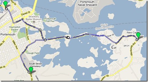
road1e

Don’t rush as you follow 1B to center Newcastle.  There are some nice views across the bay on this stretch, and some cute back roads overlooking the bay (with nice homes) once you get near Newcastle.  At the very top of Newcastle turn left onto Wentworth Rd., and the Portsmouth Coast Guard station, marker #4 William and Mary Raids is just on your right with a little parking and picnic area.

If you have the time visit the old fort now known as Fort Constitution.  There is parking outside the gate of the station, and they don’t mind you visiting.  Just stay on the blue line! The fort itself has placards describing what went on there, and what you’re seeing.  Oh, and there’s a light house to photograph as well, if you can find the right vantage point. This is yet another un blogged marker, but we’re getting close.
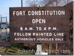
#4 zpic1 #4 zpic3

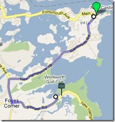
road1fThe next marker is only a few miles away, #72 Odiorne’s Point.  As you leave the coast guard station, continue along Rt. 1B (Wentworth Rd), and when it ends, turn left on Sagamore Ave.  At the rotary, go left on Rt 1A.  The marker is located on the left, just across the bridge before the entrance to the Odiorne Point boat launch.

The site of the first settlement in New Hampshire by David Thompson now hosts a very nice State Park.  There are plenty of walking paths to be explored, remains of some of the original settlement foundations, and the Seacoast Science Center to visit.  The main entrance is down the road from the marker on the left.  Check the State Park web site (link above) for opening dates and such.
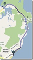
road1g

When ready, continue down Rt 1A to the next mark … err … post sticking out of the ground.  Yes, it’s the infamous marker #18 Isles of Shoals.  As you drive down 1A, the post is on the left at a small parking area, just after Fairhill Ave.  The marker was vandalized, removed and never replaced.  It read:

About six miles directly out to sea, this cluster of islands abounds in legend and history. Before 1614, when the famous Captain John Smith mapped the rocky and surf-lashed Isles, early fishermen, traders and explorers had a part in their history.

18web11[1]

A clear day will offer a great view of the islands in the distance.  If you’re trying to take pictures a telephoto lens is probably a good idea.

The next marker is down the road a bit, almost exactly 3 miles, so set your odometer.  No map for this one!  Take it slow and enjoy the views as you pass Wallis Sands State Beach, Rye Harbor State Park and then turn inland for a bit.  Once inland, on the left after Locke Rd.,  Marker #63 Atlantic Cable Station and Sunken Forest is hiding at the edge of the marsh.
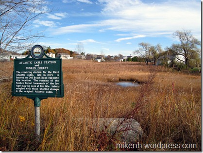
#63 zpic1

The receiving station for the first Atlantic Cable, laid in 1874, is located on Old Beach Road opposite this location. The remains of the Sunken Forest (remnants of the Ice Age) may be seen at low tide. Intermingled with these gnarled stumps is the original Atlantic Cable.

Fun fact: I received an email from a reader pointing out that this is not, in fact, the first Atlantic Cable station (Backed up with facts).  I look forward to researching this marker in the future. And now it’s on to the final marker for this road trip.
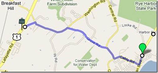
road1h

About .2 miles south of the last Marker, turn right on Cable Rd., then right, onto Central Rd.  Next, turn left onto Grove Rd. which ends at Washington Rd.  A left onto Washington.  Your 5th left is Dow Lane, turn down there it ends at Rt 1.  The marker is actually just a bit south on Rt 1at the Rye/North Hampton town line.

62zpic1[1]

And so we come full circle.  Marker #62 Breakfast Hill.  The companion marker to the first marker from this trip, Portsmouth Plains.

On the hillside to be seen to the north of this location a band of marauding Indians and their captives were found eating their breakfast on June 26, 1696, following the attack at the Portsmouth Plains. When confronted by the militia the Indians made a hasty exit leaving the prisoners and plunder. This locality still enjoys the name of Breakfast Hill.

Postscript:

Whew, this was a lot longer than intended and covered a lot of ground. It looked good mapping it all out.  The distances between markers is pretty short, but explaining it all seems wordy.

I’d like to ask regular readers what you think.  Are these worthwhile?  To many markers?  Need something short to print?  Any and all comments welcome.

Be well!

Mike


Thanks for the tickets!

27 02 2010

Well timed twitter luck!   Thanks to the fine folks at nh.com for a free pair of tickets to see “The Chieftans” in Lowell in a few weeks. They were in the mailbox today.

The ChieftansIf you haven’t visited nh.com, head on over and see all they have to offer.  It’s a well put together web resource for NH residents or visitors.  News, events, recommendations for all kinds of activities, hotels, or restaurants.

The have a pretty good list of New Hampshire bloggers as well, broken down into categories.  Email them to get your blog added to the list.  If you use twitter, follow them.

(This post is a unabashed plug for the nh.com website, because they sent me free stuff.  And I like the web site. I hear disclaimers might be needed for this sort of thing.  So here it is.)


Marker #31 The Chocorua Legend

22 02 2010

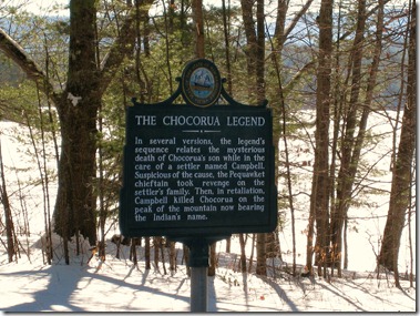
#31 The Chocuroua Legend

Marker Text:

In several versions the legend’s sequence relates the mysterious death of Chocorua’s son while in the care of a settler named Campbell. Suspicious of the cause, the Pequawket chieftain took revenge on the settler’s family. Then, in retaliation, Campbell killed Chocorua on the peak of the mountain now bearing the Indian’s name.

This marker is located on Rt 16 in Tamworth, near the northern end of Lake Chocorua.  It was erected in 1965.

#31 

Town-Seal-RGB[1]Anyone who has driven up Rt 16 toward Conway from Ossipee has probably seen the  bare rocky crag that is the peak of Mount Chocorua (Cho-KOO-roo-wa). It’s a favorite climb for day hikers and offers terrific views from the exposed summit.  The Mountain, the Chief and the Legend all pre-date the founding of the town of Tamworth in 1766.

The conflict of the French and Indian war of the early 1700s faded by1720, but tension remained between the French and British colonists over the Acadia region.  Begining in 1721 Dummer’s War would involve the Ossipee and Tamworth area.  That topic is for an upcoming marker, but it’s important to try to get the timing right on The Chocorua Legend.

There are many tellings of this legend.  In some Chocorua is a loner, in others a survivor of Dummer’s war. Sometime’s he has a son, and sometime’s he doesn’t.  He is Hero, villain, or innocent bystander. But the ending is always the same.

#31 zpic7 Mount Chocorua, looking north across a frozen Lake Chocorua.  January 2010

For 40 years before the legend of Chocorua the French and English colonists fought over land in New England. It was in this new environment of settlers and war that he lived most of his life as the local tribes gave way to – and were used by – the newcomers.

Chocorua, however had always had friendly relations with the English.  Richard Andros, in his poem from Chocorua and other sketches (1838) describes a weary, beaten and sick man who has lost all family and tribe to the pestilence and war, before finding a sympathetic woman living alone in her cabin.  She nurses him to health and he pledges eternal friendship with the white man.

In the 1835 Lady’s Cabinet Album  (a reader to excite the ladies of the day)  Chocorua is a local icon well known around the small settlement near the mountain with a young son.  He befriends a family with children his own sons age, the Campbell’s, before tragedy strikes.  Cornelius Campbell and his wife Caroline had fled England after the return of Charles II.  Soon after arriving in Boston they tired of the crowds of the city and set out to find a place a place to settle into a more peaceful life.

choc2

Chocorua spent his entire life on and around “his” mountain.  It happened that one day he was called to a tribal meeting and left his son in the care of the Campbell’s.  Chocorua’s son and the Campbell children were  fast friends and often were found sampling the treats and foods that Caroline prepared. 

Wolves and foxes were a problem in the area often terrorizing the livestock of the Campbell’s.  Despite his best attempts with traps and rifle, Cornelius had little luck in stopping them.  Finally he prepared a poison that would end the problem once and for all.  But it seems he forgot to heed the advice “Keep out of reach of children.”  Chocorua’s son, mistaking the bottle for a liquid treat prepared by Caroline, sampled the poison.

51866W6EBYL._SL500_AA240_[1] It was a slow death. The Campbell’s fretted over the boy all that day and through the night trying in vain to help him.  By morning he had fallen into a deep sleep from which he would never wake.  They  buried him near a stone at the edge of the forest.

On his return Chocorua was devastated.  He retreated to his mountain feeling betrayed. The anger inside him would build even as he grieved for his son and revenge became his only thought.  He would stay in isolation until the time was right.

One bright morning Cornelius loaded his wagon with corn to take to the mill some 10 miles away.  While he was away Chocorua struck.  He butchered  Caroline and the children in the cabin then retreated once more to his mountain.

Cornelius would return home to a forever changed life.

In such a mind, grief, like all other emotions, was tempestuous. … the remembrance of their love clung to him like the death grapple of a drowning man, sinking him down, down, into darkness and death. This was followed by a calm a thousand times more terrible—the creeping agony of despair, that brings with it no power of resistance.

These who knew and reverenced him, feared that the spark of reason was for ever extinguished. But it rekindled again; and with it came a wild, demoniac spirit of revenge. The death-groan of Chocorua would make him smile in his dreams …

There was no need to guess where Chocorua may have gone.  There was only one place he would go – his mountain. Campbell assembled a party of men to go after him and headed for the mountain. They pursued Chocura and drove him to the top of the mountain, finally cornering him at the edge of a cliff.  Campbell leveled his rifle and ordered Chocorua to jump.

choc1 Chocorua refused saying “The Great Spirit gave life to Chocorua; and Chocorua will not throw it away at the command of a white man!”  Campbell fired, wounding Chocorua in the neck. 

Chocorua reeled from the shot, teetering on the edge of the precipice, but he recovered enough to raise both hands bravely and in a defiant voice said, “A curse upon ye, white men!  May the Great Spirit curse ye when he speaks in the clouds, and his words are fire!  Chocorua had a son—and ye killed him while the sky looked bright!  Lightning blast your crops!  Wind and fire destroy your dwellings!  The Evil Spirit breathe death upon your cattle!  Your graves lie in the war-path of the Indian! Panthers howl, and wolves fatten over your bones!  Chocorua goes to the Great Spirit—his curse stays with the white men!”

His curse completed Chocura threw himself over the cliff and fell to his death.

Afterword:

The curse above is from the Lady’s Cabinet Album, and is repeated in a current book “Cursed in New England”.  There is another version in Andros’ poem that reads;

Great spirit, hear!
If innocence can aught avail with thee,
Let not my blood go down, without revenge,
To earth! but may my curse rest on this spot
Forever! and each thing—each living thing,
Perish upon these hills! and blight, and death,
And desolation wrap the scene!

The Lady’s album (The story by Lydia Maria Childs) speaks of Chocorua falling down dead and  Andros has him jumping. So it is with legends.  No doubt there was a Chocorua at the time, and the Campbell’s were certainly real enough.  Trying to track down the details is like playing “Telephone” across centuries.


Back at it.

16 02 2010

It’s been nearly a week since my computer decided to jump off the Hudson bridge into the Merrimack.  The good news as I mentioned in my last post was that I was able to save the data.  The even better news is a spiffy new laptop!

So I’ll be back at the New Hampshire markers again with a vengeance.  I lost some research time, but the next marker will be “The Chocourua Legend.”  It will be up this week.

Thanks to all for your patience

Mike