#85 Nottingham Chartered 1722

9 03 2010

#85 Nottingham

Marker Text:

Two miles north on Route 156 (one mile ahead) is Nottingham, home of Revolutionary War Patriots, Generals Thomas Bartlett, Henry Butler, Joseph Cilley, and Henry Dearborn who was later a Congressman, Secretary of War, and Minister to Portugal. Monuments in Nottingham Square, five miles north, commemorate these men and the 1747 massacre of Elizabeth Simpson, Robert Beard and Nathaniel Folson by Indians of the Winnipesaukee Tribe.

This marker is located on Rt 27/107 in Raymond, about 3/4mi west of the junction of Rt 156.  Nottingham Square is 5 miles north on Rt 156.

#85

Land grants were coming fast and furious in the 1700s.  Massachusetts had pretty standard language for all of them, and reading this stuff can put you to sleep quick.  I hope that’s not the case here as we see how a town on the edge of the frontier came to be.

The Nottingham land grant is the next in the expansion of New Hampshire, extending a protective ring westward from the coast. Old Dunstable-1673, the Scotch-Irish settlement (Londonderry)-1719, and The Two Mile Streak-1719 in Barrington were all being populated around this time.  When Nottingham is added (containing today’s towns of Nottingham, Deerfield and Northwood) there is an effective wall set up to help guard against Indian attacks and expand the wealth of New Hampshire.  A map might help here.

notmap2 The grants of the early 1720s.

The request for a land charter was submitted without a suggested name to Boston on April 19, 1721 and signed by 101 men. Boston responded on April 28th:

We, the dwellers at Boston, being in number a considerable part of the persons entered in a petition late granted by the authority of New Hampshire, April 21,1721, for settling a town norwestward of Exeter, etc., at a meeting among ourselves duly warned,

It is voted, That the tract of land contained and set forth in the said petition shall be called New Boston, if our brethren at Newbury and elsewhere are of the same mind, and the gentlemen of the province of New Hampshire approve of ye same to whom we submit the matter.

The people named in the charter were of many different backgrounds and motives.  Most of them came from coastal areas from Portsmouth to Boston. Land speculators were involved, as were entrepreneurs trying to expand their wealth.  Many were veterans of various Indian wars – or their heirs -  granted land as payment for service to the colonies.  20 New Hampshire men were added to the charter in December 1721 by the folks in Exeter who were responsible for it’s execution.

Town of Nottingham SealBut all of them – regardless of station or wealth – were required meet the terms of the grant.  The Royal Charter from George I, dated May 10, 1722 lays out all the details of elections and such.  Each “Proprietor” was required to build a house and plow up and fence in at least 3 acres of land within 3 years, and plant the fields in the 4th year.  Oh, and the charter changed the name to Nottingham.

Land was set aside for the Proprietors to build a town Meeting House, school and parsonage within 4 years.  They were also required to pay for any protection that may be needed and a town minister.

Charter in hand, the Proprietors went about the business of building a town.  Planning meetings were held in Portsmouth or Exeter.  At the first meeting in Exeter in June it was decided that “Major John Gilman, Capt. John Gilman and Capt. John Wadleigh be a committee to agree with men to build a bridge and make good ways to Nottingham.” As noted in a previous post, the Gilman family were quite influential in early Exeter.

There were no roads.  The bridge in question was over the Lamprey River to facilitate connecting the town to Exeter.  It took 2 years to build a way in, survey the land and finally get to the point where they could parcel out land.

The description of the chosen town center from 1724 is told to us thusly:

notmap3 “But the position chosen for the compact part of the town was "beautiful for situation." It was upon the height of a large swell of land, gently sloping in every direction. It was twenty-five miles south-east from what is now the state capital, fourteen miles north-west from Exeter, and twenty west from Portsmouth. The blue waters of the Atlantic, and the white canvas of vessels entering the harbor at Portsmouth, could be distinctly seen; while little lakes sparkled like gems in the wilderness, and Pawtuckaway Mountain gracefully rose in the west, and Saddleback in a more northerly direction, and babbling streams, affording ample water-power, found their way along the valleys. Here, at an elevation of about four hundred and fifty feet above the sea level, they laid out a compact village with great exactness in the form of a cross.“

The small map above (click for big) shows Nottingham Square today, with the originally laid out roads in the form of a cross. The four streets were originally named King St (Southeast to Exeter and the Lamprey bridge), Fish St. (Southwest to “Tuckaway” pond), Bow St (Northwest to Bow pond), and North St. (Northeast toward North River). Roads are said to have been built “Four Rods wide” – about 64 feet!

Parcels of land at the center were assigned to the meeting house, schools, and of course, special plots for the Governor and Lt. Governor.  A total of 134 plots were parceled and lots drawn for ownership.  Generally, the further from town, the more acreage.

The first meeting held in Nottingham itself occurred in 1727 in the town “Block House” – or meeting house.  By then the roads had been laid, town center built and folks were beginning to work the land.  The first order of business was to raise funds to build a mill on the “Tuckaway” river to process lumber.

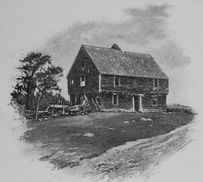
Like many of the settlements around this time lumber, charcoal and Ships Masts (required by law to be sent to England for the Navy) were the main sources of income.  Farming was of less value because of our rocky soil, but it was good land for raising livestock and planting crops for a family’s use.

Over the next 60 years as Nottingham grew, people in the farther reaches of the town were complaining that it was to far to the town center.  The original planners misjudged the actual size of the grant and positioned the town center in the southeast corner of the grant.  Deerfield would later be set off as it’s own town in 1766, and the folks who lived in what they then called the “North Woods” would split again in 1773 to become Northwood.

It’s hard to imagine the New Hampshire of the 1720s-1730s. Mr. Elliott Colby Cogswell History of Nottingham, Deerfield, and Northwood 1878  gives a glimpse into the early pioneer spirit.

notpic "VARIOUS motives prompted men to engage in the settlement of some of our towns. Some were actuated by a spirit of enterprise. They delighted in seeing highways cut through the wilderness, smoke ascending from many a hill-top, — sign that the woodman’s ax was effecting clearings and rude dwellings were being constructed for those who were willing to dare and endure. It was for the greater safety of the lower towns to have the frontiers extended further from the coast-line, and the towns that were the centers of trade and influence encouraged every attempt to effect a new settlement.”

Postscript:

Mr. Cogswell’s book, celebrating the Northwood centennial was the only source used for this post.  The proceedings of the event are covered, including poetry, song, speeches, etc.  I didn’t read all the speeches (they sure could speechify back then) but enjoyed “The Old Elm Tree” by S. Clarke Buzell was my favorite of those I did.  Check it out if you have a moment extra.


Road Trip 1: The Seacoast, Portsmouth and Rye *Updated!*

3 03 2010

*UPDATE* Printable PDF Road Trip 1

With spring just a few weeks away it’s time to introduce a new blog feature, Road Trips!  This is the first of what I hope will be many that will be cataloged by region in the Road Trips menu bar above.

If you have a request for a trip through a particular region, the Road Trips page is open for comments.  Go ahead and leave a suggestion, and I’ll work one up.

The Seacoast inside I95 is home to 14 markers (15 if we include the Weeks House just on the other side of the highway).  Marker Icons on the maps have blog posts already, green placemarks do not. Blogged markers are linked as appropriate.

There are 2 clusters of markers inside I95; Portsmouth/Rye and Hampton/Seabrook.

This Road Trip will cover the northern markers through Portsmouth, down the coast, and finishing up at the North Hampton/Rye border on Rt 1.  9 markers with an optional 10th (Weeks House).  Hampton and Seabrook will be the next road trip (and a shorter one, at that).

Part 1: Portsmouth.

75zpic1[1] The first marker is #75 Portsmouth Plains . From I95 (north or south) get off at Exit 3, and take a right at the end of the ramp.  The Marker is about a mile past the interstate on your left.   From the south coast, get on Rt 1 north, and take a left at the lights after Lafayette Plaza Shopping Center onto Peverly Hill Rd, the left at the junction of Rt 33 (about a mile) the marker is just to your right.  Not much to see here except a baseball field. It’s more a drive-by marker than a stop and visit marker.  It was a different place 314 years ago.

In the pre-dawn hours of June 26, 1696, Indians attacked the settlement here. Fourteen persons were killed and others taken captive. Five houses and nine barns were burned. This plain was the Training Field and Muster Ground. Close by stood the famous Plains Tavern (1728-1914) with its Bowling Green where many distinguished visitors were entertained.”

road1bFrom here take a right on Peverly Hill Rd just to the east, cross Rt 1 at the lights onto  Elwyn Rd.  Marker #127, John Langdon.  It’s on the left about 1/4 mile past Rt 1.

Signatory to the Constitution, Governor, President of the U.S Senate among other amazing accomplishments.  He was born on this farm in 1741.  This marker is different from many others, the text continues on the reverse side.  The house is open for tours from June through October, or you can rent the grounds for your next shindig.

Mr. Langdon will be covered in detail once we get to the Revolution.

Our next marker is #194 Wentworth- Coolidge Mansion.  Continue east on Elwyn Rd. to the Rotary, then north on Sagamore Ave.  The marker is a mile ahead, just past the intersection with Little Harbor Rd.  Take a right on Little Harbor Rd and follow it to the end to get to the actual Mansion.

road1c

I hope you brought some snacks to munch along the way, as this is a beautiful spot on a nice day. The official State Park page is here. I’d recommend this spot for some great photo opportunities.  Here are a few from a visit last fall.

#194 zpic3 #194 zpic5

When you’re finished taking in the view, hop back in the car and head back out to Sagamore Ave.

This next marker is optional.  If you don’t mind navigating across downtown, then backtracking through the city again,  head for marker #114 North Cemetery.  It’s from 1753, and has many famous New Hampshire residents buried there.  Skip ahead if you’re eager to get to the coast markers.

road1d

It’s about a mile to the Cemetery. Once back at Sagamore Ave (Rt. 1A), take a right and follow 1A.  Sagamore turns into Miller Ave, and ends at the lights at Middle St, Rt. 1.  Turn right onto Middle St and stay on Middle.  Cross State St. and Islington St., you’re on Maplewood Ave.  The cemetery and marker are 1/4 mile ahead on your left, across from the old Portsmouth Herald building.

“The Town of Portsmouth purchased this land in 1753 for 150 pounds from Col. John Hart, commander of the N.H. Regiment at Louisburg. General William Whipple, Signer of the Declaration of Independence, Gov. John Langdon, Signer of the Constitution, Capt. Thomas Thompson, of the Continental Ship Raleigh, are among noted citizens buried here.”

John Langdon, you may remember, we met a few markers ago.  Did you know Portsmouth has a committee to preserve old graves?  Wander down to the right end of the cemetery, and you’ll find the “Old Union” section with a plaque describing some of the people buried there.  After getting your fill here, it’s time to meet up with the folks that skipped this marker for the coast ride.

From the cemetery, turn back around the way you came and head back to State St, and turn left. At the 2nd light, turn right onto Pleasant St, which turns into Rt 1B.

Part 2: The Coast.

If you are skipping the marker #114, take a right on Sagamore Ave., and at the light at the end of the cemetery, turn right onto South St.  You’re looking for Newcastle road on the right (less than 1/2 mile), turn right.  When the road ends,turn right on 1B.  We’re all one big happy group again.

road1e

Don’t rush as you follow 1B to center Newcastle.  There are some nice views across the bay on this stretch, and some cute back roads overlooking the bay (with nice homes) once you get near Newcastle.  At the very top of Newcastle turn left onto Wentworth Rd., and the Portsmouth Coast Guard station, marker #4 William and Mary Raids is just on your right with a little parking and picnic area.

If you have the time visit the old fort now known as Fort Constitution.  There is parking outside the gate of the station, and they don’t mind you visiting.  Just stay on the blue line! The fort itself has placards describing what went on there, and what you’re seeing.  Oh, and there’s a light house to photograph as well, if you can find the right vantage point. This is yet another un blogged marker, but we’re getting close.

#4 zpic1 #4 zpic3

road1fThe next marker is only a few miles away, #72 Odiorne’s Point.  As you leave the coast guard station, continue along Rt. 1B (Wentworth Rd), and when it ends, turn left on Sagamore Ave.  At the rotary, go left on Rt 1A.  The marker is located on the left, just across the bridge before the entrance to the Odiorne Point boat launch.

The site of the first settlement in New Hampshire by David Thompson now hosts a very nice State Park.  There are plenty of walking paths to be explored, remains of some of the original settlement foundations, and the Seacoast Science Center to visit.  The main entrance is down the road from the marker on the left.  Check the State Park web site (link above) for opening dates and such.

road1g

When ready, continue down Rt 1A to the next mark … err … post sticking out of the ground.  Yes, it’s the infamous marker #18 Isles of Shoals.  As you drive down 1A, the post is on the left at a small parking area, just after Fairhill Ave.  The marker was vandalized, removed and never replaced.  It read:

About six miles directly out to sea, this cluster of islands abounds in legend and history. Before 1614, when the famous Captain John Smith mapped the rocky and surf-lashed Isles, early fishermen, traders and explorers had a part in their history.

18web11[1]

A clear day will offer a great view of the islands in the distance.  If you’re trying to take pictures a telephoto lens is probably a good idea.

The next marker is down the road a bit, almost exactly 3 miles, so set your odometer.  No map for this one!  Take it slow and enjoy the views as you pass Wallis Sands State Beach, Rye Harbor State Park and then turn inland for a bit.  Once inland, on the left after Locke Rd.,  Marker #63 Atlantic Cable Station and Sunken Forest is hiding at the edge of the marsh.

#63 zpic1

The receiving station for the first Atlantic Cable, laid in 1874, is located on Old Beach Road opposite this location. The remains of the Sunken Forest (remnants of the Ice Age) may be seen at low tide. Intermingled with these gnarled stumps is the original Atlantic Cable.

Fun fact: I received an email from a reader pointing out that this is not, in fact, the first Atlantic Cable station (Backed up with facts).  I look forward to researching this marker in the future. And now it’s on to the final marker for this road trip.

road1h

About .2 miles south of the last Marker, turn right on Cable Rd., then right, onto Central Rd.  Next, turn left onto Grove Rd. which ends at Washington Rd.  A left onto Washington.  Your 5th left is Dow Lane, turn down there it ends at Rt 1.  The marker is actually just a bit south on Rt 1at the Rye/North Hampton town line.

62zpic1[1]

And so we come full circle.  Marker #62 Breakfast Hill.  The companion marker to the first marker from this trip, Portsmouth Plains.

On the hillside to be seen to the north of this location a band of marauding Indians and their captives were found eating their breakfast on June 26, 1696, following the attack at the Portsmouth Plains. When confronted by the militia the Indians made a hasty exit leaving the prisoners and plunder. This locality still enjoys the name of Breakfast Hill.

Postscript:

Whew, this was a lot longer than intended and covered a lot of ground. It looked good mapping it all out.  The distances between markers is pretty short, but explaining it all seems wordy.

I’d like to ask regular readers what you think.  Are these worthwhile?  To many markers?  Need something short to print?  Any and all comments welcome.

Be well!

Mike


Marker #161 Ladd-Gilman House

8 02 2010

#161 Ladd-Gilman

Marker Text:

Built about 1721 as one of New Hampshire’s earliest brick houses, and enlarged and clapboarded in the 1750s, this dwelling served as the state treasury during the Revolution. Here were born John Taylor Gilman (1753-1828), who was elected governor for an unequalled total of fourteen years, and his brother Nicholas Gilman, Jr. (1755-1814), a signer of the U.S. Constitution. The house has been maintained since 1902 by the Society of the Cincinnati.

Located at the Ladd-Gilman house on Water St. in downtown Exeter, the Marker was erected in 1991. (Leftmost Placemark below)

#161

The Ladd-Gilman House gives us a chance to return to Exeter one more time before the Revolutionary War. This is a chance to catch up with Exeter’s history since the last marker from more than 80 years ago.  After Rev. Wheelwright was booted out of town in 1642 and Exeter came under the jurisdiction of Massachusetts, the town began to be settled in earnest. 

Exeter was a desirable place to settle for many reasons. As the Exeter river goes over the falls it becomes the Swampscott river and is part of Great Bay.  Back then, before the construction of dams, salmon were plentiful as they headed from the ocean up the Exeter river to spawn.   The Swampscott river, being a tidal river, provided access to Dover, Strawberry Banke and the ocean.  Alewives were plentiful above the falls providing an opportunity to build fisheries and use the harvested fish to fertilize the soil as land was cleared  and farms built.  The first mill was erected on the east side of the river on the Exeter river falls (map above, center right).  The homes of the settlers were generally on the west side of the river.

As with any new town representatives were selected, taxes set out for the common cause, plots of land claimed and bickered about, grumbles about Massachusetts Government and people generally being people.  Into this new town being structured came a wealthy man named Edward Gilman:

the settlement in Exeter of Edward Gilman in 1647, and his relatives shortly afterwards, men of property and energy, who set up saw-mills and gave an impulse to the business of the place. Bell, History of Exeter

The Gilman family prospered in Exeter as more of the family moved into the town.  Over the next 50 years Exeter would grow steadily,  the primary exports being ship masts, barrel staves and other products produced at the mills.  The first garrison house would be built by a Gilman and still stands today at 12 Water Street (map above, lower right).

Nathaniel Ladd was born in Haverhill MA in the 1650s, married Elizabeth Gilman and eventually settled in Exeter.  He managed to get into a bit of trouble in 1683 when he took part in Gove’s rebellion. Many were angry at provincial Governor who had dissolved the assemblies elected by the people to appoint his own guys. Ladd and 11 others (probably fortified with spirits) rode from Exeter to Hampton with guns and sword at the ready.  They were all arrested except Ladd who managed to escape and went into hiding for a while. Nathaniel Ladd would meet an early death participating in a raid on the Indian settlement at Casco Bay in 1691.  His eldest son, Nathaniel II would build what is today the Ladd-Gilman House.

ladd-gilman HDR Ladd-Gilman House, 11/09

IMG_0226 The original house is all brick, but was clapboarded over later when additions were added in the 1750s.  Through marriage between the Ladd and Gilman families in the 1700s the house was eventually owned by the Gilmans.  Today the house is part of the American Independence Museum in Exeter, and displays historic documents including original drafts of the Declaration of Independence.  Also on the museum property is the Folsom Tavern (pictured above), built in 1775 on the corner of today’s Front and Water streets.  It was moved to this location in 2004. And before you ask, yes, George Washington visited here in 1783.

There will be a little more on this important building in posts about the revolution.


Marker #96 The Two Mile Streak

27 01 2010

#96 Two Mile Streak

Marker Text:

Granted in 1719 to encourage industrial development in the province and called New Portsmouth, this two-mile wide strip of land was set aside to provide homesites for imported workers at the Lamprey Ironworks. Wood from this strip was converted to charcoal for the Ironworks. Absorbed by the 1722 Barrington Grant, the area retains its identity as The Two-Mile Streak. Descendants of early settlers still live here.

This marker was erected in 1974.  It’s located on the east side of Rt. 125, about one and a half miles south of Rt. 9 in Barrington.

#96

Before getting to the Two Mile Streak it’s worth mentioning that the influx of settlers to New England really started to take off in the early 1700s.   Businessman had begun erecting mills on the rivers around Great Bay.  Townships and protective Garrisons were being established along the Merrimack river, and Portsmouth was the center of New Hampshire trade and government

As the population grew, so did the need for resources and trade goods.  Ship masts and lumber were in great demand, and most of the Great Bay area had been clear-cut by 1715 or so.  The trees were cut, masts and lumber made, then shipped off to England for the King.  The settlers needed homes and food, and the resources needed to keep flowing in and out of New Hampshire. Farms and markets were increasing in number and the colony was prospering quite well.  The population by 1720 was nearing approximately 10,000-15,000 people in the towns surrounding Great Bay, double what it had been only 10 years earlier. 

Abundant resources – and profits – attracted prominent and wealthy merchants to our shores.  Among them was a successful captain from Scotland, Archibald MacPheadris, who made his fortune as a sea captain and trader before coming to New Hampshire.  His first ventures here were in the fir trade and lumber exports.  He developed a  good relationship with the Indians and set up a network of outposts and employees to acquire firs.  Investing money in the building and running of lumber mills along the rivers feeding Great Bay produced valuable lumber.  Exporting his products back to London made him one of the richest and most important men in Portsmouth at the time.

Today you can still see his legacy at the home he built in Portsmouth, “The Warner House"

Warner House 1024 Warner House photo provided by and copyright of Philip Case Cohen.  Visit his blog, The Daily Portsmouth!  Check out his Virtual Gallery while you’re over there.

Construction began in 1716 or so (accounts vary) and was completed in 1718.  All of the original brick was imported from Holland, and the cost to build it was a then staggering  £6,000! It was completed in time to present as a gift to his new wife Sarah Wentworth.  She was one of the 16 children of Governor John Wentworth.  MacPheadris was well connected.  They had one child, Mary, who would later marry a gentleman named John Warner.  The home now bears his name.  To read a very interesting detailed history of the house, Volume 7 of the Granite Monthly of 1883 has quite the colorful story.

Now we can get to the Two Mile Streak!

One of  the ventures MacPheadris established in New Hampshire was the first Ironworks in the state, the “Lamprey Ironworks.”

Making Iron is no small thing.  First you have to find the ore, which was dug out of the bogs in the area.  Then you have to smelt it.  That means heat, and lots of it.  MacPheadris needed trees to burn into charcoal to keep his furnace hot, and people to dig up Bog Iron ore and man the Ironworks. It was backbreaking, dirty hot work.  MacPheadris brought employees over from England to man his project.

The Iron was turned into everything from home fixtures (nails, hinges, door handles, etc.) to household goods such as pots and plates. (Photo above is the Iron Furnace in Franconia, click it to visit the web site)

In 1719 the resources required to support the operation were awarded in the form of the Two Mile Streak.  Two miles wide, and six miles long it is today the eastern side of Barrington.  Homes were built for the families of the men that worked for the Ironworks, and the wood of the land kept the furnace going. The streak can be clearly seen in this portion of a 1784 map by Samuel Holland (click to enlarge).

two mile streak

In 1722 the Streak became part of the Barrington Grant that created that township (and included what is today Strafford). The same charter created the towns of Chester, Nottingham and Rochester.  Barrington would begin to be settled in earnest in the mid 1730s.

The Lamprey Ironworks operated until MacPheadris’ death in 1728.  He had been an entrepreneur, magistrate in Portsmouth, part of the Kings Council and pioneer in developing New Hampshire trade and early industry. The homesteads built for his workers and their families were the first in Barrington.

Today’s Rt. 125 enters Barrington from Lee in the Streak, and runs north through this land grant all the way to the Rochester border.  It’s not very impressive when you drive along, but it played an important part in our history, thanks to Captain Archibald MacPhaedris.

He was Capt. Archibald Macpheadris, a yellow-haired Scotchman, as crotchety as his late countryman, Carlyle, an indefatigable worker, a prosperous merchant and speculator, whose thrift brought him wealth.”


Marker Twofer! #75 Portsmouth Plains and #62 Breakfast Hill.

6 12 2009

These two markers belong together.  They both commemorate the same event a few miles apart.

#75 Portsmouth Plains

Marker text:

In the pre-dawn hours of June 26, 1696, Indians attacked the settlement here. Fourteen persons were killed and others taken captive. Five houses and nine barns were burned. This plain was the Training Field and Muster Ground. Close by stood the famous Plains Tavern (1728-1914) with its Bowling Green where many distinguished visitors were entertained.

This marker is located on Rt. 33 in Portsmouth, about 2 miles East of I95 on Middle Rd.

#75

#75 zpic1 Part of Portsmouth Plains today is a Baseball field.


Bonus Marker #62!

#62 zpic1

Marker #62, Breakfast Hill

Marker text:

On the hillside to be seen to the north of this location a band of marauding Indians and their captives were found eating their breakfast on June 26, 1696, following the attack at the Portsmouth Plains. When confronted by the militia the Indians made a hasty exit leaving the prisoners and plunder. This locality still enjoys the name of Breakfast Hill.

This marker is located on Rt. 1 North, in North Hampton.  As you can see from the Photo, it is right at the Rye town line.

#62

The Native American attacks, spurred on by the French, had been occurring since the late 1680s.  The Massacre at Oyster River in the summer of 1694 set the New Hampshire settlements on edge.  Since that day, small Indian raids, harassment and mutilation of livestock and the occasional killing or kidnapping contributed to the anxiety they felt going about their daily lives.

Thursday the 25th of June was a cool unsettled day with occasional lightning and rain.  Early in the day a party of Indians  from the York, ME / Nubble area were seen paddling up the Piscataqua from Portsmouth.   Word spread quickly among the settlements to keep people alert for potential mischief.  That afternoon at Portsmouth Plains the livestock came out of the woods where they had been grazing and seemed somewhat agitated.  Was it just the storm, or were there Indians waiting to attack?  The villagers suspected Indians but decided to stay in their homes for the night instead of seeking the safety of the nearby Garrison.

Etching of a late 1600s Garrison House

As the daylight faded and the people of Portsmouth Plains settled in for the night the Massacre MarshIndians that had previously been seen paddling up the Piscataqua probably slipped quietly back down the river in the dark to meet up with the rest of the raiding party at  what is today Rye.  Previous raids into this area had been launched from south of Ordiorne’s Point.  In 1691 a raiding party came ashore and killed 21 people, burning homes and taking hostages at what is today still called Massacre Marsh. They were also from York/Nubble.  Massacre Marsh is about 2 miles south-east from Portsmouth Plains, and would have provided a safe hiding place for their canoes.

The raiding party made their way to Portsmouth Plains during the night.  Just before dawn they set fire to the barns and outbuildings of the village, only then screaming their war cries to wake the people.  They charged the houses, looting anything that could be easily carried and killed as they went.  The women and children that could escape while the men put up a defense ran for the garrison house just north of the Plains.  The elderly and injured attempted to hide in the nearby woods.

The men of the village fought as well as they could but they were outnumbered.  It was only a matter of time before they too had to retreat to the garrison. 

The raiding party knportsmouth plains routeew the path to the garrison and positioned men along the path in the forest.  They killed, maimed or captured villagers that were alone or in twos as they tried to reach safety.

By the time the garrison had organized a response and returned to Portsmouth Plains, the raiders were gone.  The march to the Plains was a gory one.  Many dead and wounded lay on the path, including 33 year old Mary Brewster.  At first they thought her dead.  She had been scalped and her head split by a tomahawk.  Her head would later be mended with a silver plate and she would go on to live a good long life to the age of 81.

Arriving at the Plains the men of the garrison counted five homes burned. Nine barns in total were destroyed, two of them filled with grain and livestock for the village. There were more dead and wounded. Captain William Shackford of Dover was among the men at Portsmouth Plains that morning and led the pursuit of the raiding party. Following their trail south, they finally found them.  The Indians had stopped to eat on a hillside that is to this day called Breakfast Hill.

The Indians had placed the captives between themselves and any pursuers that may come after them providing a human shield in case they were discovered.  A direct assault would not work without killing the hostages.  Shackford sent men around the hill for the attack.  As the men charged out of the woods the Indians they fled into the marshes to the east and disappeared.   They hid in the marshes the rest of the day, slowly making their way back to the coast and hidden canoes by nightfall.  Shackfords men saved all the hostages and recovered everything that had been stolen by the raiding party.

Portsmouth had been alerted to the attack in the morning and expected the Indians may try to sneak away in the dark.  Men were sent up the Pascataqua to stop escape to the west.  Commander Gerrish was assigned with some Sloops to patrol the coast to cut   off if any attempted escape by sea.    The raiding party was spotted that night attempting to escape North up the coast and Gerrish set the line of sloops in their path.  Unfortunately he misjudged the distance to the raiders in the dark and gave the order to fire early, while they were out of range.  The Indians quickly turned to the open ocean  paddling for  the Isles of Shoals.  Gerrish attempted to chase them but could not catch them as the disappeared around the Isles and headed North back to York.


Postscript: Most of the histories have some mention of this incident all the way back to Belknaps first history.  By far the most complete is found in Rambles About Portsmouth pp 71-76, written by an early Portsmouth columnist Charles Brewster.  This re-telling is based on his account of what happened that day.


Marker #113 Weeks House

23 11 2009

#133 Weeks House

Marker Text:

Leonard Weeks settled here in 1658 on 33 acres of land which he left to his son Samuel, who built the house about 1710. The bricks were made on the premises. Hand hewn oak beams support the 18-inch thick walls, which were cracked by the earthquake of 1755. Occupied by the family over 250 years, it is considered the oldest native brick house in New Hampshire.

This Marker was erected in 1976 and is located on the north side of NH 33, about a half mile west of its junction with NH 151.


#113 

#117 weeks arial view Aerial view, marker location (1) and the Week’s House.

The story of the Weeks house is also the story of the settling of Greenland, NH.  A large tract of land here was originally given to  Capt. Francis Champernowne, British Nobleman between 1640 and 1644.  The original land grants for New Hampshire and Maine were given to Mason and Georges, repevtively and New Hampshire first settled by Thompson and Hilton and. Champernowne was a young boy at the time, but Georges married one of his relatives back in England, and was probably influenced by him to eventually come to New England. (Capt. Francis Champernowne: The Dutch conquest of Acadie p89.)

Champernowne was very loyal to King Charles I who was having some problems keeping his royal subjects in line.  There was a Civil War going on back in England. The two main factions were the Royalists that believed in the Divine Right of King’s, and the Parliamentarians that believed in a more representative Commonwealth – this included the Puritans, many of which were in early New England.

As a result, he was busy captaining a ship and harassing Massachusetts Bay colony trade in the Madeira Isles (off the coast of Portugal) for much of the 1640s.

Map picture

In his absence he hired an agent to take care of his holdings.  Additional land grants were given to him as well, and the one in 1655 is the most important for this story:

“In 1655 the town made to him a further grant of three hundred and seventy-five acres of `marsh, meadow, and upland.` This grant was laid out in the same year, and was referred to in conveyances of land in Greenland for more than half a century as Champernowne’s "new farm."  …

He lived on his Greenland farm until the month of July, 1657, when he conveyed it to Valentine Hill, upon some agreement with Hill to satisfy a claim of Captain White, and for other considerations. Hill immediately conveyed the farm to Thomas Clarke and William Paddy, merchants of Boston.”

Capt. Francis Champernowne: The Dutch conquest of Acadie p109-111

And so he sold his land in 1657 and moved to Maine where he also had land that had been originally given to his father.  He died there in 1686.

Leonard Weeks originally came to New Hampshire around 1648 at the age of 15 on one of Champernowne’s ships, and worked the farm land for him.  In 1556 recieved his first land grant in Greenland.  Seems our new land owner liked to cuss as well, he was the first person in Greenland ever tried at the county court in Portsmouth in 1660, charged with:

"Swareing by god & Callinge John Hall of Greenland ould dogg & ould Slave &  that he would knocke him in the head: this is testifid by Thomas Peverley & Joseph Attkinson."

It cost him 10 shillings.  That’ll teach him!

He married and had eight children here, and expanded his land holdings further. Near the end of his days, he bequeathed his property to his second son Samuel Weeks and died a year later in 1707.

Samuel Weeks was a Captain of the Greenland militia, Selectman, and filled many other important city functions for Greenland.  He built the Weeks House around 1710…

#133 zpic2

…and this is what it looks like today (click to enlarge) November, 2009. It’s still a private residence.  He died in 1746 but left a beautiful and lasting representation of the early settlers of New Hampshire.  Visit the Weeks Brick House web site, and the Greenland Weeks Public Library for all your Greenland History needs.

The marker notes: “Hand hewn oak beams support the 18-inch thick walls, which were cracked by the earthquake of 1755.”  I can’t let a tidbit like this go by without checking into it.  The Massachusetts Historical Society has some information.

At about 4:30 in the morning on 18 November 1755, a strong earthquake rocked the New England area. Observers reported damage to chimneys, brick buildings, and stone walls in coastal communities from Portland, Maine to south of Boston, Massachusetts. Chimneys were also damaged as far away as Springfield, Massachusetts, and New Haven, Connecticut. The earthquake was felt at Halifax, Nova Scotia, to the northeast, Lake Champlain to the northwest, and Winyah, South Carolina to the southwest. The crew of ship in deep water about 70 leagues east of Boston thought it had run aground and only realized it had felt an earthquake when it arrived at Boston later that same day.

Find out here.


Marker #28 First Public School

13 11 2009

IMG_0242

Marker Text:

In New Hampshire, supported by taxation, the first public school opened in Hampton on May 31, 1649. It was presided over by John Legat for the education of both sexes. The sole qualification for admission of the pupils was that they be "capable of learning."

Erected in 1965 in Hampton, this marker is on the front lawn of the Centre School, on Winnacunnet Road.

#28 

IMG_0243

Ok, where to start. I guess we start down in Massachusetts again where the Governor was busy creating new laws for the towns.  This one was known as “The Old Deluder, Satan Act” of 1647. Oh my!

 “How Conveeeeenient!”

Here’s the first few Paragraphs of the Law (PDF):

It being one chief project of that old deluder, Satan, to keep men from the knowledge of the Scriptures, as in former times by keeping them in an unknown tongue, so in these latter times by persuading from the use of tongues, that so that at least the true sense and meaning of the original might be clouded and corrupted with false glosses of saintseeming deceivers; and to the end that learning may not be buried in the grave of our forefathers, in church and commonwealth, the Lord assisting our endeavors.

It is therefore ordered that every township in this jurisdiction, after the Lord hath increased them to fifty households shall forthwith appoint one within their town to teach all such children as shall resort to him to write and read, whose wages shall be paid either by the parents or masters of such children, or by the inhabitants in general, by way of supply, as the major part of those that order the prudentials of the town shall appoint; provided those that send their children be not oppressed by paying much more than they can have them taught for in other towns.

Actually, teaching children to read and write for the primary purpose of reading and studying the Bible isn’t a bad idea (Don’t tell the NEA or ACLU). There is however a historical story that should be looked at.  Witches!  Oh yeah!

Though Salem, MA gets all the good Witch press, the fact is that folks back in jolly old England had been executing suspected Witches since the late 1500s, and really started going crazy in 1645. And it had spread.  All the way to Massachusetts.

"The first suspicion of witchcraft in the New England colonies began at Springfield, Massachusetts, as early as 1645. Several persons were, about that time, tried and executed in Massachusetts; one at Charlestown, one at Dorchester, one at Cambridge, and one at Boston. For almost thirty years afterwards, the subject rested.”

So by 1647, the Governor wanted to make sure that expanding towns had a school where children could learn to read and write.  The reasoning, is that they would be able to read the Bible themselves, and not be lied to by Witches about what it contains. Perfectly reasonable.

A bit about the first teacher in New Hampshire, John Legat, before we resume.  He was a Hampton resident as early as 1640, but had since moved to Exeter.  The town hired him in 1649:

"On the 2 of the 2 Mo; 1649: The Selectmen of this Towne of Hampton have agreed with John Legat for this present yeare ensueing. To teach and instruct all the children of or belonging to our Towne, both Mayle and Femaile (wch are capiable of learning) to write and read and cast accountes, (if it be desired), as diligently and as carefully as he is able to teach and instruct them; And so diligently to follow the said imploymentt att all such time and times this yeare ensueing, as the wether shall be fitting for the youth to com together to one place to be instructed; And allso to teach and instruct them once in a week, or more, in some Arthodox chatechise provided for them by their parents or masters. And in consideration hereof we have agreed to pay, or cause to be payd unto the said John Legat, the som of Twenty pounds, in corne and cattle and butter att price currant, as payments are made of such goods in this Towne, and this to be payd by us quarterly, paying £5 every quarter of the yeare after he has begun to keep school."

Not a bad curriculum.  Reading, writing, some math if the parents of the students wanted it, and a religious class at least once a week that the parent would specify for their child.  But I don’t think he was happy with the pay. Cows, corn and butter paid once a quarter?  In October of 1650 he sued over his wages, but later dropped the complaint.

Now back to the Witches!


Hampton did end up with a Witch or two as well.  The most famous is Goody Cole, who was imprisoned in 1656, beating the Salem brouhaha by  20 years.

Goodwife Eunice Cole, the witch of Hampton, was for a quarter of a century or more the terror of the people of that town, who believed her to have sold herself body and soul to the Devil. Whom we hate we also fear. The bare mention of her name would, it is said, hush crying children into silence, or hurry truant boys to school. Although she was repeatedly thrown into prison, she was yet unaccountably suffered to continue to live the life of an outcast, until death finally freed the community from their fears. In 1680 she was brought before the Quarter Sessions to answer to the charge of being a witch; and though there was "noe full proof" that she was a witch, yet for the satisfaction of the Court, which "vehemently suspects her so to be," and probably too of the people, Major Waldron, the presiding magistrate, ordered her to be imprisoned, with "a lock kept on her leg," at the pleasure of the Court.

As she was first prosecuted as early as 1656, she must have been a very old woman when this harsh sentence was pronounced. For some years–how many it is not known–Goody Cole lived alone in a hovel which stood a little way back from the spot where the Academy now [1884] stands; and in this wretched hut, without a friend to soothe her last moments, she miserably died. Several days elapsed before her death became known; and even then, such was the fear her supposed powers had inspired, that it required a great deal of courage on the part of the inhabitants to force an entrance into her cabin, where she lay dead. When this had been done, the body was dragged outside, a hole hastily dug, into which it was tumbled, and then–conformably with current superstition–a stake was driven through it, in order to exorcise the baleful influence she was supposed to have possessed.

Samuel Adams Drake 1884


Goody Cole left quite a legacy.  In 1937 the town of Hampton passed a  resolution clearing her of all charges.  And she was immortalized in two poems by John Greenleaf Whittaker: The Wreck of the Rivermouth, and The Changeling.

The Changeling

by John Greenleaf Whittier

For the fairest maid in Hampton
They needed not to search,
Who saw young Anna Favor
Come walking into church,-

Or bringing from the meadows,
At set of harvest-day,
The sweetness of the hay.

Now the weariest of all mothers,
The saddest two years’ bride,
She scowls in the face of her husband,
And spurns her child aside.

"Rake out the red coals, goodman,-
For there the child shall lie,
Till the black witch comes to fetch her
And both up chimney fly.

"It’s never my own little daughter,
It’s never my own," she said ;
"The witches have stolen my Anna,
And left me an imp instead.

"Oh, fair and sweet was my baby,
Blue eyes, and hair of gold ;
But this is ugly and wrinkled,
Cross, and cunning, and old.

"I hate the touch of her fingers,
I hate the feel of her skin ;
It’s not the milk from my bosom,
But my blood, that she sucks in.

"My face grows sharp with the torment ;
Look ! my arms are skin and bone !
Rake open the red coals, goodman,
And the witch shall have her own.

"She’ll come when she hears it crying,
In the shape of an owl or bat,
And she’ll bring us our darling Anna
In place of her screeching brat."

Then the goodman, Ezra Dalton,
Laid his hand upon her head :
"Thy sorrow is great, O woman !
I sorrow with thee," he said.

"The paths to trouble are many,
And never but one sure way
Leads out to the light beyond it :
My poor wife, let us pray."

Then he said to the great All-Father,
"Thy daughter is weak and blind ;
Let her sight come back, and clothe her
Once more in her right mind.

"Lead her out of this evil shadow,
Out of these fancies wild ;
Let the holy love of the mother
Turn again to her child.

"Make her lips like the lips of Mary
Kissing her blessed Son ;
Let her hands, like the hands of Jesus,
Rest on her little one.

Comfort the soul of thy handmaid,
Open her prison-door,
And thine shall be all the glory
And praise forevermore."

Then into the face of its mother
The baby looked up and smiled ;
And the cloud of her soul was lifted,
And she knew her little child.

A beam of the slant west sunshine
Made the wan face almost fair,
Lit the blue eyes’ patient wonder
And the rings of pale gold hair.

She kissed it on lip and forehead,
She kissed it on cheek and chin,
And she bared her snow-white bosom
To the lips so pale and thin.

Oh, fair on her bridal morning
Was the maid who blushed and smiled,
But fairer to Ezra Dalton
Looked the mother of his child.

With more than a lover’s fondness
He stooped to her worn young face,
And the nursing child and the mother
He folded in one embrace.

"Blessed be God !" he murmured.
"Blessed be God !" she said ;
"For I see, who once was blinded,-
I live, who once was dead.

"Now mount and ride, my goodman,
As thou lovest thy own soul !
Woe’s me, if my wicked fancies
Be the death of Goody Cole !"

His horse he saddled and bridled,
And into the night rode he,
Now through the great black woodland,
Now by the white-bleached sea.

He rode through the silent clearings,
He came to the ferry wide,
And thrice he called to the boatman
Asleep on the other side.

He set his horse to the river,
He swam to Newbury town,
And he called up Justice Sewall
In his nightcap and his gown.

And the grave and worshipful justice
(Upon whose soul be peace !)
Set his name to the jailer’s warrant
For Goodwife Cole’s release.

Then through the night the hoof-beats
Went sounding like a flail ;
And Goody Cole at cockcrow
Came forth from Ipswich jail.


Marker #151 Newington

9 11 2009

IMG_0270

Marker Text:

Boundary disputes among the early river settlers caused this area to be called Bloody Point. By 1640 Trickey’s Ferry operated between Bloody Point and Hilton’s Point in Dover. In 1712 the meeting-house was erected and the parish set off, named Newington for the English village, whose residents sent the bell for the meeting-house. About 1725 the parsonage was built near the town forest, considered one of the oldest in America.

This Marker is in an odd place. From Rt.16 take exit 4, the Marker is located just west of the Rt 16 underpass on Shattuck Way.

 #151

The actual location of Bloody Point, and Trickey’s Ferry was on the other side of the highway at the end of Bloody Point Road (marked here as River Rd).  It may be private property, I didn’t go look.

Here’s a Birds Eye view of the end of Bloody Point Road, and the probable location of the Ferry.

Map picture

The name “Bloody Point” can be traced back to the early 1630s.  Capt. Mason, one of the original Grantees of the NH area had sent over two officers Capt. Wiggins, and Capt. Neal, to manage and run the New Hampshire settlement. Wiggins was responsible for the “upper” settlement, Hilton’s Point, and north, and Neal the “Lower Settlement”  Ordiorn’s Point, from today’s Rye and all of today’s Portsmouth and Newington.

Wiggin and Neal had a bit of a disagreement over who actually owned this little spit of land.  They almost settled it the old fashioned way. Sabers, or Pistols at ten paces … you get the idea.  They did peaceably decide, and no blood was really spilled, but the point bears the name of the conflict.

Captain Neal and Captain Wiggin, rival agents, came near shedding blood there, about the possession of the land; " but," says the worthy Mr. Hubbard, " both the litigants had so much wit in their anger as to waive the battle, each accounting himself to have done very manfully in what was threatened ; so as in respect merely of what might have fallen out, the place to this day retains the formidable name of Bloody Point" In 1643, the Bloody Point part was in controversy between Portsmouth and Dover; but it was assigned to Dover.

A History and description of New England Vol1 1859 Page 598

Trickey’s ferry ran from Bloody Point, across to Hilton’s Point in Dover and also provided passage across the river to “Kittery Neck.”  Thomas Trickey owned the farm and land the ferry was on. He died before 1680.  The land was eventually purchased by Captain John Knight (a Huguenot who came to the New World for religious freedom) in 1705, who owned and operated the ferry until 1718 or so, then transferred the operation to his son.  He was a selectman at Newington in 1721, which was soon recognized as a town.

The first bridge spanning the two points was the General Sullivan (aka “Little Bay”) Bridge was completed in 1934.

Miss Thompson, a descendant of John Knight, and the local historian, says : — In a wild, lonely spot is the grave of John Knight, the exile, shaded by sassafras trees and tall white birches, whose boles gleam afar off like shafts of polished marble. It is marked by a low, broad, three-lobed headstone of slate, on which is this inscription :

"Here lyes buried the body of John Knight Esq ,born August ye 30th 1659 and died May the 11th 1721."

Items of Ancestry, 1894, pp45-46


Marker Twofer! #103 Shapley Line and #120 Bound Rock

4 11 2009

IMG_0248 Marker Text:

Based on the 1640 southern boundary of Bachiler‘s farm, it was surveyed by Capt. Nicholas Shapley in 1657, dividing the Province of New Hampshire from the Massachusetts Bay Colony from 1689-1741. In 1662 three Quaker women, being banished from the territory, were freed south of here by Constable Walter Barefoot. Edward Gove, imprisoned in the Tower of London for leading the rebellion against Lt. Gov. Cranfield in 1683 lived nearby.

This Marker is located on US1 in Seabrook, at the corner of Rocks Road, and was erected in 1975


And the Bonus Marker:

IMG_0249

Marker Text:

This rock, originally in the middle of the Hampton River, indicated the start of the boundary line surveyed by Capt. Nicholas Shapley and marked by him "AD 1657-HB and SH" to determine the line between Hampton and Salisbury, HB meaning Hampton Bound and SH, Shapley’s mark. Lost for many decades due to the shifting of the river’s mouth, the original course of the river and the Bound Rock were rediscovered in 1937. This historically important boulder, still serving as a boundary marker, was enclosed by the State of New Hampshire that same year.

Located on a small lot near the End of Woodstock St. At the Light south of the Hampton Harbor Bridge, turn into Hookset St, then left on Ocean Drive, and Left on Woodstock.

#103 

This pair of markers represent the settlement of a longstanding feud between the towns of Hampton and Salisbury.  As we have seen previously, the Early New Hampshire Towns were eventually ceded to Massachusetts because of the confusion over the various grants.

Once the Reverend Bachilor recieved his land grant for his farm, the good folks in nearby Salisbury (there was no Seabrook then) complained to the Massachusetts Bay Court that the land belonged to them.  The bickering and surveying went on for years, until finally, in May 1657 Capt. Shapley surveyed the border and the court settled the matter.

The westernmost end of the line was originally a very large tree that stood where the Shapley Marker now is, and was replaced by the stone you can see in the top photo.  The eastern end was marked by Bound Rock.

For many years Bound Rock was lost to the shifting coastal sands and meandering of the Hampton river.  It was re-discovered in 1937.  The town of Hampton purchased the small lot of land it was found on.  As it was found below the ground and an enclosure was built for it.

IMG_0250 November , 2009

The day I was there, looking through the grate that covers then enclosure, all that was visible was a lot of water.  From this photo, it looks as though the rock is about 20 feet below ground.

Lane Memorial Library photo


With the settling of this border spat, the borders of the first 4 towns in New Hampshire – Strawberry Banke (Portsmouth), Dover, Exeter, and Hampton – were defined.

Here is a Map I highlighted to emphasize the town boundaries.  The original is from  Stackpole’s History, Vol 1, Page 31.

shapleyClick the image for a large version.


Marker #119 Old Landing Road

2 11 2009

IMG_0234

Marker Text:

“This was the first roadway from the ancient landing on Hampton River taken on October 14, 1638, by Rev. Stephen Bachiler and his small band of followers, when they made the first settlement of Hampton, originally named Winnacunnet Plantation. For the next 160 years this area was the center of the Town’s activity. During that period and into the Town’s third century, Landing Road provided access for fishing, salt-marsh haying, mercantile importing and exporting, and transportation needs of a prospering community.”

It’s Located east of US 1, at the corner of Park Avenue and Landing Road at Founders Park, near Winnacunnet High School. Erected in 1977.

#119 

IMG_0236

Founders Park, Hampton. 11/01/09

The story of Rev Bachiler is an interesting one.  By the time he made it here to Hampton in 1638 he was already around 77 years old.  His story begins for us with his arrival in Massachusetts in 1632.  For details of his life before arriving here, the Lane Memorial Library, in Hampton has a terrific treasure trove of information on-line

Bachiler first settled in Lynn MA and headed a church there.  But he, like Reverend Wheelwright the Founder of Exeter, ran into trouble with with the Puritan Church in Massachusetts Bay.

In February, 1636, Bachiler moved to Ipswich, the home of John Winthrop, where he received 50 acres of land, but, apparently discouraged by his troubles at Sagus, gave up the active work of the ministry. This latter fact was mentioned in a letter of the period from a Puritan minister in England, as a result of the reign and bigoted spirit in New England, which deterred many from coming to this country.

Early in 1638, in the winter time, Bachiler tried to form a settlement near Yarmouth on Cape Cod, where his Wing grandchildren lived; and walked there from Ipswich. But, says Winthrop, "He and his company being poor men, gave it over, and others undertook it." In the spring of 1638, he removed to Newbury …

Victor Sanborn, 1898

Now there’s an old man with some good shoes! Walked from Ipswich, near Gloucester all the way to Yarmouth half way down Cape Cod.

It was in September of 1638 that Bachiler and others recieved permission for Massachusetts to establish a settlement at Winnacunnet .  “ The settlers went by shallop and begun the settlement October 14, 1638. (Stackpole, pp 47,48)

The Memorial Boulder, at Founders Park, Dedicated in 1925

IMG_0235

Memorial Boulder, November 2009

It seems that scandal of one sort or another followed Bachiler wherever he went.  In 1641 when Massachusetts swallowed up New Hampshire he was soon booted out of the church, then let back in later.  By 1644 he had been pastor in Exeter, returned to Hampton, finally settling in Strawberry Banke. You can read all the gory charges, machinations and politicking here, here, and here.

In his mid-80s now and hoping to live out his life peacefully at Strawberry Banke, life would throw him another curve-ball by the name of Mary.  In 1647 and probably infirmed, a young woman was assigned to assist him in day to day life.  She turned out to be a gold digger that tricked him into marriage in 1648.

This woman was, of course, much younger than her deluded husband; but her original name and age are unknown. She soon passed over into the jurisdiction of Gorges’ colony, living on her land in Kittery, and used her married name as a cover for vice. In October, 1650, she was arrested on suspicion of adultery with one George Rogers, and a year later the York records show that she was convicted of the offence, and sentenced to receive forty stripes save one at the first town meeting held at Kittery, six weeks after her delivery, and be branded with the letter "A."  F. B. Sanborn – 1900

Could she have been the inspiration for Hester Prynne in Nathanial Hawthorne’s The Scarlet Letter? The parallels are intriguing.


He petitioned for divorce, Gov. Winthrop refused. He returned to England where he died near London in 1656.

I really want to thank the Lane Memorial Library in Hampton again.  Your web site was invaluable for this and markers to come.