Marker Text:
“New Hampshire, as granted by authority of the English Crown to Captain John Mason in 1629, was bounded on the west and north by a curved line 60 miles distant from the sea. The course of this proprietary boundary, called the "Masonian Curve," coincides with the nearby town line between Wilmot and Springfield.”
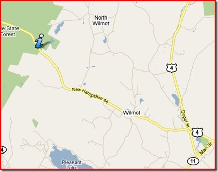
It’s located on the west side of NH 4-A, just south of the Springfield-Wilmot town line, and was erected in 1966.
Good thing for all of you that I love maps! This one had search engine’s working overtime. The Map at the top (which should open into a new tab or window) is based on an old map, found in of all places, “History of the Town of Goffstown,” which proved to be a great source for this marker.
In 1629, Captain Mason petitioned the Plymouth Company again for a new patent, after the interlopers from Massachusetts tried to take a big chunk of the Laconia Grant (See the last post for details). And he got it:
“…for the land from the middle of Pascataqua river, and up the same to the farthest head thereof, and from thence northwestward, until sixty miles from the mouth of the harbor were finished ; also, through Merrimack river, to the farthest head thereof, and so forward up into the land westward, until sixty miles were finished; and from thence to cross over land to the end of the sixty miles accounted from Pascataqua river; together with all islands within five leagues of the coast." This tract of land was called New Hampshire.
So the King reaffirmed Mason’s patent, and our good Right Reverend Wheelwright was out some coats and kettles. Wheelwright wasn’t done. We’ll save that for another marker.
The basic problem with all these Grants, patents, companies and charters is no one knew what was inland! They had no clue which way the rivers flowed, turned or forked. Lakes? What lakes?
Open the top Curve map, and we’ll take a look at how it was made. My curve isn’t perfect, but it’s a fair representation based on the Goffstown map. Notice how the town borders often follow the curve? The Springfield Wilmot border (and the marker) is just about at the mid point of the curve.
Why did they draw a curve? Glad you asked! The idea is that once the end points were defined, any place along the curve would be 60 miles from the ocean.
The Northern end point of the curve came about by following the Pascataqua to it’s head waters, which happen to be at Great East Lake in Wakefield, a bit over 30 Miles (straight line) from Hilton’s Point. That’s where the squiggly part of our border with Maine stops, and shoots straight north . 30 miles due north, is the border between Conway and Fryburg, Me. 60 Miles to the sea!
It took over one hundred years to settle all the border and boundary issues between New Hampshire and Massachusetts. In the end, the New Hampshire border runs from about 3 miles above the outlet of the Merrimack and keeps that distance above the Merrimack until it turns sharply North. It’s about 30 miles as the Crow flies. Then, the border runs straight west. At the 30 mile point, you’ll find the end point of the Curve 60 Miles from the coast!
I love maps. All kinds of maps. and Google Earth. But I think you may have figured that out already.


