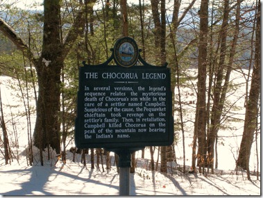
Marker Text:
In several versions the legend’s sequence relates the mysterious death of Chocorua’s son while in the care of a settler named Campbell. Suspicious of the cause, the Pequawket chieftain took revenge on the settler’s family. Then, in retaliation, Campbell killed Chocorua on the peak of the mountain now bearing the Indian’s name.
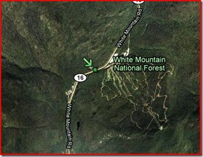
This marker is located on Rt 16 in Tamworth, near the northern end of Lake Chocorua. It was erected in 1965.
![Town-Seal-RGB[1] Town-Seal-RGB[1]](https://mikenh.files.wordpress.com/2010/02/townsealrgb1.jpg?w=91&h=91) Anyone who has driven up Rt 16 toward Conway from Ossipee has probably seen the bare rocky crag that is the peak of Mount Chocorua (Cho-KOO-roo-wa). It’s a favorite climb for day hikers and offers terrific views from the exposed summit. The Mountain, the Chief and the Legend all pre-date the founding of the town of Tamworth in 1766.
Anyone who has driven up Rt 16 toward Conway from Ossipee has probably seen the bare rocky crag that is the peak of Mount Chocorua (Cho-KOO-roo-wa). It’s a favorite climb for day hikers and offers terrific views from the exposed summit. The Mountain, the Chief and the Legend all pre-date the founding of the town of Tamworth in 1766.
The conflict of the French and Indian war of the early 1700s faded by1720, but tension remained between the French and British colonists over the Acadia region. Begining in 1721 Dummer’s War would involve the Ossipee and Tamworth area. That topic is for an upcoming marker, but it’s important to try to get the timing right on The Chocorua Legend.
There are many tellings of this legend. In some Chocorua is a loner, in others a survivor of Dummer’s war. Sometime’s he has a son, and sometime’s he doesn’t. He is Hero, villain, or innocent bystander. But the ending is always the same.
 Mount Chocorua, looking north across a frozen Lake Chocorua. January 2010
For 40 years before the legend of Chocorua the French and English colonists fought over land in New England. It was in this new environment of settlers and war that he lived most of his life as the local tribes gave way to – and were used by – the newcomers.
Chocorua, however had always had friendly relations with the English. Richard Andros, in his poem from Chocorua and other sketches (1838) describes a weary, beaten and sick man who has lost all family and tribe to the pestilence and war, before finding a sympathetic woman living alone in her cabin. She nurses him to health and he pledges eternal friendship with the white man.
In the 1835 Lady’s Cabinet Album (a reader to excite the ladies of the day) Chocorua is a local icon well known around the small settlement near the mountain with a young son. He befriends a family with children his own sons age, the Campbell’s, before tragedy strikes. Cornelius Campbell and his wife Caroline had fled England after the return of Charles II. Soon after arriving in Boston they tired of the crowds of the city and set out to find a place a place to settle into a more peaceful life.
Chocorua spent his entire life on and around “his” mountain. It happened that one day he was called to a tribal meeting and left his son in the care of the Campbell’s. Chocorua’s son and the Campbell children were fast friends and often were found sampling the treats and foods that Caroline prepared.
Wolves and foxes were a problem in the area often terrorizing the livestock of the Campbell’s. Despite his best attempts with traps and rifle, Cornelius had little luck in stopping them. Finally he prepared a poison that would end the problem once and for all. But it seems he forgot to heed the advice “Keep out of reach of children.” Chocorua’s son, mistaking the bottle for a liquid treat prepared by Caroline, sampled the poison.
![51866W6EBYL._SL500_AA240_[1] 51866W6EBYL._SL500_AA240_[1]](https://mikenh.files.wordpress.com/2010/02/51866w6ebyl-_sl500_aa240_1.jpg?w=104&h=104) It was a slow death. The Campbell’s fretted over the boy all that day and through the night trying in vain to help him. By morning he had fallen into a deep sleep from which he would never wake. They buried him near a stone at the edge of the forest.
It was a slow death. The Campbell’s fretted over the boy all that day and through the night trying in vain to help him. By morning he had fallen into a deep sleep from which he would never wake. They buried him near a stone at the edge of the forest.
On his return Chocorua was devastated. He retreated to his mountain feeling betrayed. The anger inside him would build even as he grieved for his son and revenge became his only thought. He would stay in isolation until the time was right.
One bright morning Cornelius loaded his wagon with corn to take to the mill some 10 miles away. While he was away Chocorua struck. He butchered Caroline and the children in the cabin then retreated once more to his mountain.
Cornelius would return home to a forever changed life.
In such a mind, grief, like all other emotions, was tempestuous. … the remembrance of their love clung to him like the death grapple of a drowning man, sinking him down, down, into darkness and death. This was followed by a calm a thousand times more terrible—the creeping agony of despair, that brings with it no power of resistance.
These who knew and reverenced him, feared that the spark of reason was for ever extinguished. But it rekindled again; and with it came a wild, demoniac spirit of revenge. The death-groan of Chocorua would make him smile in his dreams …
There was no need to guess where Chocorua may have gone. There was only one place he would go – his mountain. Campbell assembled a party of men to go after him and headed for the mountain. They pursued Chocura and drove him to the top of the mountain, finally cornering him at the edge of a cliff. Campbell leveled his rifle and ordered Chocorua to jump.
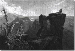 Chocorua refused saying “The Great Spirit gave life to Chocorua; and Chocorua will not throw it away at the command of a white man!” Campbell fired, wounding Chocorua in the neck.
Chocorua reeled from the shot, teetering on the edge of the precipice, but he recovered enough to raise both hands bravely and in a defiant voice said, “A curse upon ye, white men! May the Great Spirit curse ye when he speaks in the clouds, and his words are fire! Chocorua had a son—and ye killed him while the sky looked bright! Lightning blast your crops! Wind and fire destroy your dwellings! The Evil Spirit breathe death upon your cattle! Your graves lie in the war-path of the Indian! Panthers howl, and wolves fatten over your bones! Chocorua goes to the Great Spirit—his curse stays with the white men!”
His curse completed Chocura threw himself over the cliff and fell to his death.
Afterword:
The curse above is from the Lady’s Cabinet Album, and is repeated in a current book “Cursed in New England”. There is another version in Andros’ poem that reads;
Great spirit, hear!
If innocence can aught avail with thee,
Let not my blood go down, without revenge,
To earth! but may my curse rest on this spot
Forever! and each thing—each living thing,
Perish upon these hills! and blight, and death,
And desolation wrap the scene!
The Lady’s album (The story by Lydia Maria Childs) speaks of Chocorua falling down dead and Andros has him jumping. So it is with legends. No doubt there was a Chocorua at the time, and the Campbell’s were certainly real enough. Trying to track down the details is like playing “Telephone” across centuries.
