Marker #55 Baker River

12 01 2010

#55 Baker River

Marker Text:

Known to Indians as Asquamchumauke, the nearby river was renamed for Lt. Thomas Baker (1682-1753) whose company of 34 scouts from Northhampton, Mass. passed down this valley in 1712. A few miles south his men destroyed a Pemigewasset Indian village. Massachusetts rewarded the expedition with a scalp bounty of £40 and made Baker a captain.

Erected in 1968, this marker is located on Rt 25 in Rumney, about 8 miles west of I93 off exit 26, in a rest area and information station.  You’ll pass the world famous Polar Caves on the way there.

#55

The Baker River is a quiet waterway about 36 miles long with its headwaters originating on the south side of Mount Moosilauke (4800 feet).  It parallels  Rt25 in Rumney before entering Plymouth and emptying into the Pemigewasset River.

To learn the full story of Thomas Baker we’ll need to go back 8 years before the event on the marker to 1704 and the town of Deerfield Massachusetts.  It was there that a key event in Queen Anne’s War would occur and chart Baker’s course in life.  The Deerfield Massacre.

At dawn on leap day, February 29th 1704, the settlement at Deerfield came under attack from a force of 300-400 Indians and their French commanders.  Two Garrisons protected the town, one surrounded by a high palisade.  Fearing attacks, many residents spent their nights within the garrison walls.  The attack force stealthily approached the town and climbed snow drifts to get inside the palisade and open the gates.  The massacre was on.  As dawn broke hatchets fell and guns fired.  The Indians ransacked and burned homes lighting up the skies and alerting settlements to the south.

The pattern would be the same as befell Hanah Dustin from Haverhill 7 years earlier:  Strike at dawn, pillage, burn the town, take captives and escape north.  The town garrisons and militia put up a valiant fight eventually driving off the attack. 48 were killed, 140 “alive at home” (wounded) and 112 people were taken captive.

Among the captives was the town minister John Williams, who would later write a book about the event The Redeemed Captive Returning to Zion  and 22 year old Thomas Baker.  I’ll bet you thought I forgot about him by now!

To make a long story a bit shorter, Baker was taken to Montreal.  He would spend 15 months there before escaping.  In May of 1705, he and 3 others managed to get clear of Montreal making their way back to Deerfield where they arrived weak and hungry on June 8th.

The Deerfield Massacre, his capture and escape would define Bakers life.  Described as “somewhat rough in manner” he joined the King’s army and became a proficient scout.  Commanding soldiers scouting north for Indian raiding parties would be his day to day life, and he eventually earned a commission to Lieutenant.

#55-3 Now we can get to the event that earned Thomas Baker his promotion to Captain, and the naming of a river after him.  It’s not as exciting as the Deerfield massacre.

The Indians that raided Massachusetts and New Hampshire were using the Pemigewasset more often to make their escape.  Baker was assigned 30-35 men (accounts vary) for an exploratory mission up the Connecticut River Valley and then southeast to what is currently Plymouth NH.  Travelling north they went as far as what is currently Haverhill NH. On their arrival no Indians were to be seen.  Striking Inland and following the terrain the party would eventually arrive in what is today Warren, NH and the Baker River.

Baker River HDR

Baker River, at the marker with Rattlesnake Mt. in the distance, 12/09

The trip down the river was uneventful until the party arrived at the confluence of the Baker River and the Pemigewasset at today’s Plymouth.  There they encountered a small band of Indians who had made their home there.  Baker attacked, killing many including their chief, and scattering the rest.  After inspecting the village they took as many furs and supplies as they could carry, and burned the rest to the ground.  They finished their journey heading south to the Merrimack, and then to Boston to report.

The marker story ends here, but Captain Baker doesn’t.  In 1714, guiding negotiators to Montreal to gain the release of British Captives, Baker would meet his wife Margaret.  As a baby she had been taken from Dover, NH in an Indian raid in 1689.  She was given to the Catholic priests for upbringing.  She married a Frenchman named LeBeau and had three children before M. LeBeau died.

She returned to Massachusetts with Baker and they were wed in 1715.  He continued his scouting missions, became a local politician, and by 1735 had resettled in Margaret’s home town of Dover, NH.  Captain Baker died in 1735.  Mrs. Baker ran a tavern in Dover as a widow until her death in 1773.


Meanwhile, back in Europe 1700-1763

6 01 2010

At the beginning of the 18th Century Europe was relatively quiet (for them).  The end of King William’s War in 1697 held but would soon be shattered by more disputes of lines of succession.  This time it was in Spain.

King William would die in 1702, and Queen Anne would rise to the throne.  As with all changes in the monarch there were those for and against.  Scotland grumbled and passed resolutions.  England whined and passed counter resolutions.  In the end Queen Anne was seated.

The big problem was a successor after Anne.  By 1700 she had been pregnant 18 times.  Sadly, she miscarried or delivered still born children 13 times and of the live births, only one survived past 2 years of age.  His name was William and died in 1700 at age 11.

Almost immediately, Great Britain became involved in the War of Spanish Succession.  The King of Spain had died and left the Kingdom to Philip V who just happened to be the grandson of King Louis the XIV of France.  This unfortunate event threatened to unite the thrones of Spain and France because Philip was also in line to the French throne.  What a mess!  Never missing the opportunity for a good war the British, Dutch, Portuguese and the Holy Roman Empire quickly joined forces to once more beat up the French and Spanish.

And just like the previous war spilled over to the new world this one would as well.  We know it as Queen Anne’s War, or the 2nd French and Indian War.  The war in the new world stretched from South America to Canada.  Much of the fighting was by privateers in the Caribbean and along the coasts of South America, the Gulf of Mexico and Florida.  New England would play her part in the north.

The French occupied what was then known as Acadia that includes what is now large parts of Canada  including Quebec, New Brunswick, Nova Scotia and Newfoundland.  They also controlled a large hunk of Eastern Maine.  As in the previous war the French used the Indians in their territories to raid and pillage the English in New England.

Acadia and New England The French Territories, and New England 1700 (click for larger) Swiped from the Maine State Archives, thanks Maine!

The war continued until the spring of 1713, and was concluded by the signing of the Treaty of Utrecht.  England gained control of Newfoundland, Nova Scotia, Eastern Maine and New Brunswick.  In Europe it established fixed national borders, many of which survive to the present.

Queen Anne died in 1714 and would be succeeded by George I.  During his reign  things would be relatively quite on the war front.  Apart from a minor rebellion by his son (George, Prince of Wales) after he bore him a Grandson, also named … wait for it … George.  Yes, the future King George III was causing trouble even as he was born.  We’ll learn a lot more about him when we come to the American Revolution.

There was one major war on the continent during his rule, the War of the Quadruple Alliance.  Once again the spat was over succession to the Spanish throne, and who owned parts of Italy.  This time Britain and France were on the same side.  What a fickle bunch.  The war which lasted from 1718 to 1720 was finally settled.  There were no battles in the colonies as a result of this war.

George I ruled to his death in 1727, and was followed by his son, George II.  This time New England wouldn’t be able to escape the continental spat.  England went to war in 1740 in the War of Austrian Succession!  Why is it always new royalty that starts these things?  It took 4 years for the war to make it across the Atlantic, King George’s War (the 3rd French and Indian War) would rage in New England from 1744 to 1748.  I’ll cover this war more in depth with the appropriate Historical Markers.

The end of the war wasn’t the end of the argument, however.  This time the conflict started in New England!  The 4th French and Indian War began in 1754 and this time spread east across the Atlantic and by 1756 had most of the world shooting at each other.  The war ended in 1763, three years after the death of George II.  There will be much more detail about this war in posts to come, as it was one of many triggers of the American Revolution.

Finally a very short note about that baby that caused a ruckus at his birth.  King George III assumed the throne in 1760 after the death of his father.

There will be much more on this brightly dressed fellow to come.  You can count on it.


The Holidays, and previews.

21 12 2009

There hasn’t been a marker post for a week now, and I blame it on Christmas!  The holidays are here and family will arrive from around the country tomorrow.  Like many of you I’ve been doing secret shopping.  We call it bumble bee shopping here at Mikes.

“So Dad, what did you get me for Christmas”

“Bzz bzzz bzz!  I’ve been a busy bee!”

She’s 23 now, but the joke from when she was 7 is still around.  “Where are you going?” ,  “Bumble Bee!”.  Secret shopping.  It goes for birthdays and Anniversaries too.

Anyway, the last marker post finished up the 1600s.  My next post will be a “Meanwhile Back in Europe” covering 1700-1750.  I’ll try to get this up before Christmas eve.  Then the markers from that time.  This will take us nicely (I think) into the American Revolution and the part the sons and daughters of New Hampshire played in it.

There also may be  a story about a marker that has very rarely been heard of.  Proof of its existence is spotty, and the state denies it ever put it up.  But if I manage to find it, I’ll have a post in time for Christmas.

As always, thanks for visiting!

Mike


December Color on a Steel Gray Day

17 12 2009

Sue at Life Looms Large each month asks for photos capturing colors of that month.  Tough mission for me in December, as Historical Markers never seem to change color.  However, I’ll submit this one taken on an overcast December day.

Abbott Bridge Abbott Bridge, Pelham

It’s a full size image, click to see it all.  The earth tones deepen lower on the bridge from the rising and falling of the river, and then further in the reflection.  A splash of rust from a windblown pile of leaves at the far end, a pine tree across the river and clinging snow signal the oncoming winter.

The bridge was built in 1837 without mortar, and in the full size image you can see the intricacies of the stone work.


Cellar Holes and Stone Walls

15 12 2009

Sue from Life Looms Large asked a great question in the “Old Dunstable” comments:

One thing I wonder, that has nothing to do with this post, or your blog, or even the mission of your blog, is why NH has so many cellar holes in the woods. I didn’t know about them til I’d lived here about 10 years, but it seems like once I knew they existed, I’d see them often. I thought that there must be cellar holes all over the world. Then I posted a picture of one on my blog and learned that people from Pennsylvania and England were shocked that there would be cellar holes in NH. And they said they didn’t have any around them.

So if you know the scoop on why we have them and other people don’t, I would love to hear about it!

As best I can tell, there’s not a marker dedicated to Cellar Holes.  But they are pretty common all over New Hampshire.  Beyond the coast the early settlers were farmers.  In the late  1700s and the 1800s most of the forests you see today in southern NH were farmland.  That required clearing huge tracts of forests, building homesteads and outbuildings, digging up the rocks (lots of rocks) and planting the land.  The wood from the trees was milled into lumber or ship masts and sold back to England or used to build here.  The rocks turned into cellars for homesteads or underground storage.

Most notably, the rocks were turned into stone walls that lined pathways and divided fields and property boundaries.  I have one running on the front end of my home here in Hudson near the road.  They are everywhere!

Through the years, as New Hampshire shifted away from an agricultural economy (which headed into the midwest) to a more industrial economy, the farms dwindled in number, the population moved to the cities, and the forests reclaimed the land (much of it now under state or federal control).

A short bit from the NH Division of Historical Resources:

Settlers laid out roads, built houses and lived their lives. Over two hundred years later all that is left are the abandoned artifacts of that early life: their roads, their walls, their cellar holes and their scant records. Their pastures now largely reclaimed by the forest, cellar holes are a reminder of the families who worked, farmed, thrived, and struggled here before us. Their stone walls, roads, wells, and foundations offer a glimpse into a fascinating past and a dramatically changing landscape.

As you wander through the woods of New Hampshire and come across a cellar or wall, you are seeing first hand the fields and homes of some of out earliest settlers.  They are the remnant of farm houses and field boundaries, roads and lanes that the first settlers left behind.  The people that built New Hampshire lifted and placed those stones, and in the process helped build our country.

As this blog goes along, I’ll document a lot of the transition from agriculture to industry.  Hopefully, in easily digestible bits. 

There isn’t a Historical Marker for cellar holes or stone walls, but maybe there should be.  Hmm … if we can get together 20 citizens and a suitable location ….

Thanks Sue for a great question!


Marker #29 Old Dunstable

15 12 2009

#29 Old Dunstable 2

Marker text:

Was the original town, chartered by Massachusetts Bay Colony in 1673, which embraced parts of New Hampshire and Massachusetts. The New Hampshire portion of this area, following the determination of the province boundary in 1741, was subsequently divided into Hollis, Hudson, Litchfield, Merrimack, and Nashua.

This marker was originally erected in 1965 south of the old Merrimack Toll plaza on the Everett turnpike.  The toll plaza was replaced in the early 1990s by the Bedford toll, and the marker moved to its current location, on Rt. 3 south, about 1/4 mile south of exit 11.

#29

The early New Hampshire and Massachusetts settlers increased dramatically in the mid 1600s.  The major seacoast settlements were overcrowding and more people petitioned for land.  As a result, settlements began to push inland, and a perfect location for farming and milling was the Merrimack valley and its associated tributaries.

 Merrimack River Basin map, by Karl Musser

But before we learn more about Old Dunstable, how did the Merrimack Valley become such an attractive settlement area in the first ossipee place?  Let’s go back a few million years and find out.  The New Hampshire we love today at one time sat over the “New England Hot Spot” as the North American Plate moved west about 100 million years ago.  The result was a whole bunch of White Mountains, and some volcanoes such as the long dormant ring dike volcano, we call The Ossipee Mountains (left, click for map).

And then the glaciers came.  From about 70,000 years ago, to as early as 10,000 years ago the earth repeatedly warmed and cooled, as it continues to do today.  The last glaciers covered all of New Hampshire, grinding and scouring on their way down, then leaving rivers lakes and the Merrimack Valley behind on the way back.  The good news is that the glaciers receded.  The bad news is that we’re overdue to cool again.  Just saying.

Back to our settlers.  As early as 1655 land grants were being handed out in the valley.  At the time, a large tract of land would be assigned, and the person receiving the grant needed to recruit families to work and settle the area.  This continued to 1673.  That year, 26 of the proprietors of the land – or potential proprietors – petitioned the General Assembly of Massachusetts that their farms (over 14,000 acres by now) be combined into a plantation for the common good.  The assembly agreed, and “Dunstable” was founded.

dunstablehilight Map from The History of Old Dunstable page 14.  Charles Fox – 1846

I’ve highlighted the boundaries in red of the new town.  The town listed as Nashville was eventually incorporated into Nashua, and today the Nashville Historic District is located just north of downtown Nashua, on Concord St.

It’s a large piece of land – more than 200 square miles – and the inhabitants needed the security of a community vs. scattered farms.  In general their relations with the local Abenaki were cordial, many of them having become Christians.  And they were united to keep the aggressive Mohawk tribes from New York at bay.  As more settlers came into the area though, they began pushing the local tribes further away, assigning the Abenaki lands of their own.

By 1675 and the outbreak of King Philips war and his intent to “exterminate the  English”, few Garrison houses had been built.  The most settled area was in and around todays Nashua, especially where the Nashua River joins the Merrimack.  The local Abenaki, having no desire to join the fight against the English went north.  Most all of the residents of Dunstable decided to leave for the coast.  They were few, isolated and indian-attack vulnerable to attack on the frontier.

The settlers petitioned the colony for security.  The main Garrison at Dunstable was reinforced.  King Philip and the better part of his army was defeated in August the following year.  Many more fortifications were added after the war.  The settlers returned to clear the land and make their homes, and the first meeting house was erected by 1678 near the Salmon Brook settlement in Nashua.

When King Williams War came to the new world in 1689 the residents of Dunstable only numbered between 30 and 40 families and would dwindle to about 25 families by the end of the war in 1697.  Constantly worried about imminent attacks, many families left.

Things remained peaceful for 6 years until the outbreak of Queen Anne’s War in 1703.  And once again Dunstable was exposed.  The French were up to their old tricks inciting the Indians against the English.  The inhabitants of Dunstable moved into the protection of the Garrison houses.  More fortifications were erected and men and money sent from the General Assembly.  Things would not improve much, there were simply too few people and men at arms to protect the whole frontier.

countOf the 7 Garrisons in Dunstable in 1711(2 years before the end of Queen Annes War), Fox shows us a tally from the Massachusetts military records.  The small columns read: “No. of families”, “No. of male inhab.”, “No. of Soldiers.”, “Total”.

It’s a pretty sad state of affairs.  19 soldiers and 7 men able to fight.  The other 60 women and children.  The war ended in 1713 but the worry would linger even as the settlements began to grow.

Now the settlement would accelerate.  The first in Hudson was in 1710, Nutfield (now Londonderry) in 1719, Brettons Farm (Litchfield) and Chester in 1720, and Merrimack and Pelham in 1722.  The increase in people meant security in numbers and the Dunstable settlements in the Valley grew quickly. As the settlements grew larger they petitioned the General Assembly to incorporate as towns.  The names and boundaries would be defined throughout the 1730s.  Merrimac, Nottingham-West (now Hudson), Litchfield, Hollis, Townsend, Nashua, Tyngsborough, Nashville (now part of Nashua).

Finally in 1741 the long dispute between Massachusetts and New Hampshire over the boundaries was settled  and “Old Dunstable” found itself sliced nearly in half.  Not all of the newly minted New Hampshire residents were pleased, but there was not much they could do.  They had invested in land, mills, farms and homes.  If they could see us now, I’m sure they would choose New Hampshire.

Postscript:  This Marker is posted out of order.  The state marker web site (where I swiped my database) has numbers transposed, listing the charter as 1763 instead of 1673.

Finding this marker was a true pain.  They had to move it someplace!  If you are coming up Rt. 3 from Nashua the back side of the marker is blank, and I don’t remember seeing any “Historic Marker Ahead” signs in either direction.  Just look for the Citizens Bank. 

I exclusively used James Fox 1846 volume History of Old Dunstable for this article.  Of course, any errors are mine.


Marker #49 Hannah Dustin

10 12 2009

#49 Hannah Dustin

Marker Text:

Famous symbol of frontier heroism. A victim of an Indian raid in 1697, on Haverhill, Massachusetts, whence she had been taken to a camp site on the nearby island in the river. After killing and later scalping ten Indians, she and two other captives, Mary Neff and Samuel Lennardson, escaped down the river to safety.

This Marker is at the “Hannah Dustin” Park n’ Ride on Rt 4, a mile west of I93 off exit 17.  It was erected in 1967.

#49

The story of Hannah Dustin has been told many times in History books and through poetry and writings of many notable authors.  The first appeared in Cotton Mathers history of the New England colonies.

Mather

Mather had personally interviewed Dustin after her escape from captivity, and many of the other re-tellings of the tale are based on his account.

Thomas and Hannah Dustin lived in the then small frontier town of Haverhill, MA.  On Wednesday March 15th 1697 Thomas was about doing work while Hannah lay in bed recovering from the birth of her eighth child about a week earlier, with Mary Neff taking care of her.

The day was interrupted by the sudden war cries of an Indian raiding party.  Thomas grabbed his musket and ran for the house as the raid began. In her weakened condition, Hannah was in no shape to run, and begged Thomas to save the children.  The infant would have to stay with her and Mary.

Thomas gathered the children and told them to run for the Garrison house while he held off the Indians should they pursue.  And they did.  Accounts vary about the childrens escape and Thomas’ deeds, but all agree that Thomas held off the Indians with his rifle, killing at least one attacker and getting the children to safety.  His deeds that day would eventually be immortalized in a poem by Sarah Hale (who has her own marker) called “The Father’s Choice” which begins:

Now fly as flies the rushing wind!

Urge, urge thy rushing steed!

The savage yell is fierce behind;

And Life is on thy speed.

Meanwhile, Hannah was forced from her bed and taken captive along with her nurse and infant.  After gathering all their captives together the raiding party headed back to their canoes on the bank of the Merrimack.  On the way there, Hannahs infant son was murdered by having his head smashed against an apple tree.  On the trip to the river and up the Merrimack many that were too old, slow or sick would be killed and left behind as well.

It’s difficult to imagine what Hannah Dustin was feeling.  Rage?  Sorrow?  Many have speculated in the various versions of her story, including Nathaniel Hawthorne;

hawthorne2

The raiding party and their captives covered 15 miles the first day and all struggled tocanoe keep up or die.  They travelled for 15 days all told, and as was the custom of the Indians at the time the captives were split between the participating Tribes.

Hannah and Mary Neff were given together to a band that made camp on what is today Dustin Island.  Along the way the Indians made their plans clear. After resting a few days they would travel North to Canada where the captives would be run through a gauntlet of the tribe, suffering greatly.  Afterward, if they survived, they would be sold in slavery to the French.  Not a very promising future.

#49 zpic3

At the island on their arrival were the families of the raiders, and a young man named Samuel Lennardson that had been captive for over a year and spoke the Indian language well. Hannah would concoct her plan.  She asked Samuel how the Indians killed with a single blow, and how they scalped people.  Not knowing, Samuel asked one of the raiders.  They viewed the women and boy as no threat so the Indian told him.

As the camp fire died away and the night deepened Hannah informed Mary and Samuel of her intentions.  She planned to kill the Indians and escape. 

camp Late in the night as the Indians slept the three captives took up Tomahawks and killed all the Indians but two.  One woman escaped into the forest, and a young boy was spared.  Ten lay dead.

It was time to make their escape.  On reaching the canoes, they scuttled all but one.  Mary and Samuel were anxious to leave, but Hannah had one more grisly task in mind.  She asked them to wait and disappeared into the woods back toward the camp.

She returned a short time later with ten scalps. Again, it’s hard to determine her emotions but there is no doubt revenge for the murder of her child certainly played a part.  They pushed off into the river and began the long trek back down the Merrimack to Haverhill.

Returning to Haverhill she learned that Thomas, for his brave deeds had been requested to build and run a new Garrison in town.  It’s at 665 Hilldale Ave in Haverhill, and is open occasionally as a museum. (click the picture for a web page).

Today the Monument erected to Hannah Dustin on June 17, 1874 still stands on the Island that bears her name.

#49 zpic4 Hannah Dustin Monument, December, 2009.

The complete proceedings of the unveiling of the monument is contained in the rear of the book “The Heroism of Hannah Dustin” By Col. Robert Caverly for those that may be interested.  Caverly was instrumental in acquiring the land, raising the funds and having the statue sculpted.  He delivered a historical address at the unveiling, part of which was;

To adorn and enliven such a history there are no better examples in all the events of the world, than are to be found in the lives and characters of the old New-England mothers. Try them; measure their faith, if you please, as in the days of dearth and disappointment. Measure them in the midst of conflagrations, war, and blood, or in the tranquil years of peace and plenty; or try them in the appalling perils of an Indian raid upon their houses, their little ones, and their lives. Stern in integrity, strong for endurance, firm in truth, and fervent in valor forever, they never faltered.

From the Parking area where the Marker is located, there’s a walking path down to the island and monument for those that may be in the area contemplating a visit.

#49 zpic12

#49 zpic2


#49 zpic10

daughters

Daughters of the American Revolution Magazine Volume 15 1899


Marker Twofer! #75 Portsmouth Plains and #62 Breakfast Hill.

6 12 2009

These two markers belong together.  They both commemorate the same event a few miles apart.

#75 Portsmouth Plains

Marker text:

In the pre-dawn hours of June 26, 1696, Indians attacked the settlement here. Fourteen persons were killed and others taken captive. Five houses and nine barns were burned. This plain was the Training Field and Muster Ground. Close by stood the famous Plains Tavern (1728-1914) with its Bowling Green where many distinguished visitors were entertained.

This marker is located on Rt. 33 in Portsmouth, about 2 miles East of I95 on Middle Rd.

#75

#75 zpic1 Part of Portsmouth Plains today is a Baseball field.


Bonus Marker #62!

#62 zpic1

Marker #62, Breakfast Hill

Marker text:

On the hillside to be seen to the north of this location a band of marauding Indians and their captives were found eating their breakfast on June 26, 1696, following the attack at the Portsmouth Plains. When confronted by the militia the Indians made a hasty exit leaving the prisoners and plunder. This locality still enjoys the name of Breakfast Hill.

This marker is located on Rt. 1 North, in North Hampton.  As you can see from the Photo, it is right at the Rye town line.

#62

The Native American attacks, spurred on by the French, had been occurring since the late 1680s.  The Massacre at Oyster River in the summer of 1694 set the New Hampshire settlements on edge.  Since that day, small Indian raids, harassment and mutilation of livestock and the occasional killing or kidnapping contributed to the anxiety they felt going about their daily lives.

Thursday the 25th of June was a cool unsettled day with occasional lightning and rain.  Early in the day a party of Indians  from the York, ME / Nubble area were seen paddling up the Piscataqua from Portsmouth.   Word spread quickly among the settlements to keep people alert for potential mischief.  That afternoon at Portsmouth Plains the livestock came out of the woods where they had been grazing and seemed somewhat agitated.  Was it just the storm, or were there Indians waiting to attack?  The villagers suspected Indians but decided to stay in their homes for the night instead of seeking the safety of the nearby Garrison.

Etching of a late 1600s Garrison House

As the daylight faded and the people of Portsmouth Plains settled in for the night the Massacre MarshIndians that had previously been seen paddling up the Piscataqua probably slipped quietly back down the river in the dark to meet up with the rest of the raiding party at  what is today Rye.  Previous raids into this area had been launched from south of Ordiorne’s Point.  In 1691 a raiding party came ashore and killed 21 people, burning homes and taking hostages at what is today still called Massacre Marsh. They were also from York/Nubble.  Massacre Marsh is about 2 miles south-east from Portsmouth Plains, and would have provided a safe hiding place for their canoes.

The raiding party made their way to Portsmouth Plains during the night.  Just before dawn they set fire to the barns and outbuildings of the village, only then screaming their war cries to wake the people.  They charged the houses, looting anything that could be easily carried and killed as they went.  The women and children that could escape while the men put up a defense ran for the garrison house just north of the Plains.  The elderly and injured attempted to hide in the nearby woods.

The men of the village fought as well as they could but they were outnumbered.  It was only a matter of time before they too had to retreat to the garrison. 

The raiding party knportsmouth plains routeew the path to the garrison and positioned men along the path in the forest.  They killed, maimed or captured villagers that were alone or in twos as they tried to reach safety.

By the time the garrison had organized a response and returned to Portsmouth Plains, the raiders were gone.  The march to the Plains was a gory one.  Many dead and wounded lay on the path, including 33 year old Mary Brewster.  At first they thought her dead.  She had been scalped and her head split by a tomahawk.  Her head would later be mended with a silver plate and she would go on to live a good long life to the age of 81.

Arriving at the Plains the men of the garrison counted five homes burned. Nine barns in total were destroyed, two of them filled with grain and livestock for the village. There were more dead and wounded. Captain William Shackford of Dover was among the men at Portsmouth Plains that morning and led the pursuit of the raiding party. Following their trail south, they finally found them.  The Indians had stopped to eat on a hillside that is to this day called Breakfast Hill.

The Indians had placed the captives between themselves and any pursuers that may come after them providing a human shield in case they were discovered.  A direct assault would not work without killing the hostages.  Shackford sent men around the hill for the attack.  As the men charged out of the woods the Indians they fled into the marshes to the east and disappeared.   They hid in the marshes the rest of the day, slowly making their way back to the coast and hidden canoes by nightfall.  Shackfords men saved all the hostages and recovered everything that had been stolen by the raiding party.

Portsmouth had been alerted to the attack in the morning and expected the Indians may try to sneak away in the dark.  Men were sent up the Pascataqua to stop escape to the west.  Commander Gerrish was assigned with some Sloops to patrol the coast to cut   off if any attempted escape by sea.    The raiding party was spotted that night attempting to escape North up the coast and Gerrish set the line of sloops in their path.  Unfortunately he misjudged the distance to the raiders in the dark and gave the order to fire early, while they were out of range.  The Indians quickly turned to the open ocean  paddling for  the Isles of Shoals.  Gerrish attempted to chase them but could not catch them as the disappeared around the Isles and headed North back to York.


Postscript: Most of the histories have some mention of this incident all the way back to Belknaps first history.  By far the most complete is found in Rambles About Portsmouth pp 71-76, written by an early Portsmouth columnist Charles Brewster.  This re-telling is based on his account of what happened that day.


Marker #50 Oyster River Massacre

1 12 2009

#50 Oyster River

Marker Text:

On July 18, 1694, a force of about 250 Indians under command of the French soldier, de Villieu, attacked settlements in this area on both sides of the Oyster River, killing or capturing approximately 100 settlers, destroying five garrison houses and numerous dwellings. It was the most devastating French and Indian raid in New Hampshire during King William’s war.

This marker is located on the south side of US 4, just east of its intersection with NH 108, just before the bridge over the Oyster River. Marker #89 “Major General John Sullivan” is just across the bridge to the south.

#50

#50 zpic1No Indians the day I visited. 

The Oyster River Massacre of 1694 wasn’t the first run in with the Abenaki, but it was the first organized by the French.  The trouble really began in 1675 when the Plymouth Colony went to war with the local Wampanoag Indians in King Philip’s War.

Word of the war down south spread quickly among the Native American tribes and among the settlers all over New England. Up the coast of Maine at the Kennebeck River, the settlers looked for promises from the local Indians.  They requested that they surrender their Muskets.  It didn’t go so well.  They began to attack remote settlements that were lightly guarded in Maine, and soon began doing the same in New Hampshire.

Belknap tells the tale, emphasis is mine:

and having dispersed themselves into many small parties, that they might be the more extensively mischievous, in the month of September, they approached the plantations at Pascataqua, and made their first onset at Oyster river, then a part of the town of Dover, but now Durham. Here, they burned two houses belonging to two persons named Chesley; killed two men in a canoe, and carried away two captives ; both of whom soon after made their escape.  About the same time, a party of four laid in ambush near the road between Exeter and Hampton, where they killed one, and took another, who made his escape.

Within a few days an assault was made on the house of one Tozer at Newichwannock [today’s Salmon Falls River –Mike], wherein were fifteen women and children, all of whom, except two, were saved by the intrepidity of a girl of eighteen. She first seeing the Indians as they advanced to the house, shut the door and stood against it, till the others escaped to the next house, which was better secured. The Indians chopped the door to pieces with their hatchets, and then entering, they knocked her down, and leaving her for dead, went in pursuit of the others, of whom two children, who could not get over the fence, fell into their hands. The adventurous heroine recovered, and was perfectly healed of her wound.

The two following days, they made several appearances on both sides of the river, using much insolence, and burning two houses and three barns, with a large quantity of grain. Some shot were exchanged without effect, and a pursuit was made after them into the woods by eight men, but night obliged them to return without success. Five or six houses were burned at Oyster river, and two more men killed.

These daily insults could not be borne without indignation and reprisal. About twenty young men, chiefly of Dover, obtained leave of Major Waldron, then commander of the militia, to try their skill and courage with the Indians in their own way. Having scattered themselves in the woods, a small party of them discovered five Indians in a field near a deserted house, some of whom were gathering corn, and others kindling a fire to roast it. The men were at such a distance from their fellows that they could make no signal to them without danger of a discovery; two of them, therefore, crept along silently, near to the house, from whence they suddenly rushed upon those two Indians, who were busy at the fire, and knocked them down with the butts of their guns; the other three took the alarm and escaped.

Belknap, pp 72-73

The confrontation would continue in Maine and New Hampshire until 1678, when a treaty was signed at Casco Bay in today’s Portland, ME.

The Massacre of 1694

With the onset of King Williams War the French began to to enlist Indians to do their fighting for them.  The French were mostly traders and had few major settlements and a lack of people.  The Indians would be their militia in this war.  The English settlers had signed an agreement with the local tribes to end hostilities in the Treaty of Pemaquid, and the French weren’t too happy.

Villebon, the French Governor of Acadia assigned de Vellieu and the “Fighting Priest” Thury to coordinate the attacks on the English colonies.

As usual, Dr. Belknap has the details. It’s long, but interesting! All highlights are mine:

The towns of Dover and Exeter being more exposed than Portsmouth or Hampton, suffered the greatest share in the common calamity.

The engagements made by the Indians in the treaty of Pemaquid, might have been performed if they had been left to their own choice. But the French missionaries had been for some years very assiduous in propagating their tenets among them, one of which was ‘ that to break faith with heretics was no sin.’ The Sieur de Villieu, who had distinguished himself in the defence of Quebec when Phips was before it, and had contracted a strong antipathy to the New-Englanders, being then in command at Penobscot, he with M. Thury, the missionary, diverted Madokawando and the other Sachems from complying with their engagements; so that pretences were found for detaining the English captives, who were more in number, and of more consequence than the hostages whom the Indians had given.

The settlement at Oyster river, within the town of Dover, was pitched upon as the most likely place; and it is said that the design of surprising it was publicly talked of at Quebec two months before it was put in execution.

Rumors of Indians lurking in the woods thereabout made some of the people apprehend danger; but no mischief being attempted, they imagined them to be hunting parties, and returned to their security.  At length, the necessary preparations being made, Villieu, with a body of two hundred and fifty Indians, collected from the tribes of St. John, Penobscot and Norridgewog, attended by a French Priest, marched for the devoted place.

The enemy approached the place undiscovered, and halted near the falls on Tuesday evening, the seventeenth of July. Here they formed two divisions, one of which was to go on each side of the river and plant themselves in ambush, in small parties, near every house, so as to be ready for the attack at the rising of the sun; and the first gun was to be the signal.

John Dean, whose house stood by the saw-mill at the falls, intending to go from home very early, arose before the dawn of day, and was shot as he came out of his door. This firing, in part, disconcerted their plan; several parties who had some distance to go, had not then arrived at their stations; the people in general were immediately alarmed, some of them had time to make their escape, and others to prepare for their defence. The signal being given, the attack began in all parts where the enemy was ready.

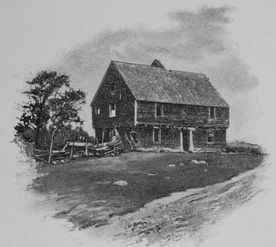
Of the twelve garrisoned houses five were destroyed, viz. Adams’s, Drew’s, Edgerly’s Medar’s and Beard’s. They entered Adams’s without resistance, where they killed fourteen persons ; one of them, being a woman with child, they ripped open. The grave is still to be seen in which they were all buried. Drew surrendered his garrison on the promise of security, but was murdered when he fell into their hands. One of his children, a boy of nine years old, was made to run through a lane of Indians as a mark for them to throw their hatchets at, till they had dispatched him. Edgerly’s was evacuated. The people took to their boat, and one of them was mortally wounded before they got out of reach of the enemy’s shot. Beard’s and Medar’s were also evacuated and the people escaped.

The defenceless houses were nearly all set on fire, the inhabitants being either lulled or taken in them, or else in endeavoring to fly to the garrisons. Some escaped by hiding in the bushes and other secret places. Thomas Edgerly, by concealing himself in his cellar, preserved his house, though twice set on fire. The house of John Buss, the minister, was destroyed, with a valuable library. He was absent; his wife and family fled to the woods and escaped. The wife of John Dean, at whom the first gun was fired, was taken with her daughter, and carried about two miles up the river, where they were left under the care of an old Indian, while the others returned to their bloody work. The Indian complained of a pain in his head, and asked the woman what would be a proper remedy : she answered, occapee, which is the Indian word for rum, of which she knew he had taken a bottle from her house. The remedy being agreeable, he took a large dose and fell asleep ; and she took that opportunity to make her escape, with her child, into the woods, and kept herself concealed till they were gone.

The other seven garrisons, viz. Burnham’s, Bickford’s, Smith’s, Bunker’s, Davis’s, Jones’s and Woodman’s were resolutely and successfully defended. At Burnham’s, the gate was left open : The Indians, ten in number, who were appointed to surprise it, were asleep under the bank of the river, at the time that the alarm was given. A man within, who had been kept awake by the toothache, hearing the first gun, roused the people and secured the gate, just as the Indians, who were awakened by the same noise, were entering. Finding themselves disappointed, they ran to Pitman’s defenceless house, and forced the door at the moment, that he had burst a way through that end of the house which was next to the garrison, to which he with his family, taking advantage of the shade of some trees, it being moonlight, happily escaped.

Still defeated, they attacked the house of John Davis, which after some resistance, he surrendered on terms; but the terms were violated, and the whole family was either killed or made captives. Thomas Bickford preserved his house in a singular manner. It was situated near the river, and surrounded with a palisade. Being alarmed before the enemy had reached the house, he sent off his family in a boat, and then shutting his gate, betook himself alone to the defence of his fortress. Despising alike the promises and threats by which the Indians would have persuaded him to surrender, he kept up a constant fire at them, changing his dress as often as he could, shewing himself with a different cap, hat or coat, and sometimes without either, and giving directions aloud as if he had a number of men with him. Finding their attempt vain, the enemy withdrew, and left him sole master of the house, which he had defended with such admirable address.

Smith’s, Bunker’s and Davis’s garrisons, being seasonably apprised of the danger, were resolutely defended. One Indian was supposed to be killed and another wounded by a shot from Davis’s. Jones’s garrison was beset before day; Captain Jones hearing his dogs bark, and imagining wolves might be near, went out to secure some swine and returned unmolested. He then went up into the flankart and sat on the wall. Discerning the flash of a gun, he dropped backward; the ball entered the place from whence he had withdrawn his legs. The enemy from behind a rock kept firing on the house for some time, and then quitted it. During these transactions, the French priest took possession of the meeting-house, and employed himself in writing on the pulpit with chalk; but the house received no damage.

Those parties of the enemy who were on the south side of the river having completed their destructive work, collected in a field adjoining to Burnham’s garrison, where they insultingly showed their prisoners, and derided the people, thinking themselves out of reach of their shot. A young man from the sentry-box fired at one who was making some indecent signs of defiance, and wounded him in the heel: Him they placed on a horse and carried away. Both divisions then met at the falls, where they had parted the evening before, and proceeded together to Capt. Woodman’s garrison. The ground being uneven, they approached without danger, and from behind a hill kept up a long and severe fire at the hats and caps which the people within held up on sticks above the walls, without any other damage than galling the roof of the house.

At length, apprehending it was time for the people in the neighboring settlements to be collected in pursuit of them, they finally withdrew; having killed and captivated between ninety and an hundred persons, and burned about twenty houses,  of which five were garrisons. The main body of them retreated over Winnipiseogee lake, where they divided their prisoners…

Belknap pp137-141


Meanwhile, back in Europe (1650-1700)

28 11 2009

Back in England this would be a half century of turmoil triggered by the English Civil wars from 1641-1651, that resulted in the execution of King Charles I, and the exile of his son, Charles II to Mainland Europe.  From the period 1651 to 1660 England was ruled as first a Commonwealth and then Oliver Cromwell’s Protectorate before Charles II returned to reclaim the throne in 1660.

Charles II would rule until his death in 1685.  During his reign he signed a secret pact with the French and promised to convert to Catholicism which he did on his deathbed.  This pact and conversion would lead to problems after his death, and have a large impact in New England.  His Catholic Brother, James II would become King for a few years before William of Orange deposed him in 1688 in The Glorious Revolution.  The English were none to happy about a Catholic Monarch.

King William III (William of Orange)

As you can probably guess, these shifting Kings and Governments reverberated back in the colonies.  Governors were appointed by Kings, Parliament had their agents there as well.  Dukes and Lords had landholdings and settlements.  All of them had to make decisions on where their loyalties lay and it impacted the individual colonists that were trying settle the land and make a few pounds on the side.  What a mess.

New Hampshire had once again gained separation from Massachusetts in 1679, and was governed by Edward Cranfield, a real character.  He was in New England mostly to scoop up as much wealth as possible by controlling who got what land that was granted to Mason and now being managed by his son.  Using the power of his office, he assigned councilors, dismissed and punished the ones that disagreed with him, convened and disbanded councils at will, etc.  He had tried raising all kinds of taxes, jailing people (including Pastors) and anything else he could think of to further his fortune. In the end, the colonists hated him.   His Sheriffs’ and Tax collectors were driven off or beaten and his orders ignored.  London finally gave him the boot in 1685, the same year James II ascended to the throne.  You can read all the political dirty details in Belknap Vol I, Chapter VIII.  It’s dry, but fascinating stuff.

James II appointed Edmund Andros, a Catholic like himself, Governor in New England December of 1686.  Andros was a loyal Royalist and another tyrant.

To particularize the many instances of tyranny and oppression which the country suffered from these men, is not within the design of this work. Let it suffice to observe, that the press was restrained; liberty of conscience infringed; exorbitant fees and taxes demanded, without the voice or consent of the people, who had no privilege of representation. The charter being vacated, it was pretended that all titles to land were annulled; and as to Indian deeds, Andros declared them no better than "the scratch of a bear’s paw." Landholders were obliged to take out patents for their estates which they had possessed forty or fifty years: for these patents, extravagant fees were exacted, and those, who would not submit to this imposition, had writs of intrusion brought against them, and their land was patented to others. To hinder the people from consulting about the redress of their grievances, town-meetings were prohibited, except one in the month of May, for the choice of town officers; and to prevent complaints being carried to England, no person was permitted to go out of the country without express leave from the governor.

Belknap V1 P119

Nice guy. But by 1689, with William of Orange ousting James II, he gets his comeuppance.

They believed Andros to be a papist; that he had hired the Indians, and supplied them with ammunition to destroy their frontier settlements; and that he was preparing to betray the country into the hands of the French.  At the same time, the large strides that King James the Second was making toward the establishment of popery and despotism, raised the most terrible apprehensions; so that the report of the landing of the Prince of Orange in England was received here with the greatest joy.

The people had now borne these innovations and impositions for about three years: Their patience was worn out, and their native love of freedom kindled at the prospect of deliverance. The news of a complete revolution in England had not reached them; yet so sanguine were their expectations, so eager were they to prove that they were animated by the same spirit with their brethren at home, that upon the rumor of an intended massacre in the town of Boston by the governor’s guards, they were wrought up to a degree of fury.  On the morning of the eighteenth of April, the town was in arms, and the country flocking in to their assistance. The governor, and those who had fled with him to the fort, were seized and committed to prison.

… Andros and his accomplices were sent home as prisoners of state, to be disposed of according to the king’s pleasure.

Belknap V1pp121-122

All of this brings us to King William’s War, or the First French and Indian War in New England.  It was New Englands part in the broader Nine Years War.  This war pitted King Louis the XIV of France against just about everyone else in Europe. 

Many of the next markers commemorate events from that war.